Datei:1246VOIVODATE.png

Größe dieser Vorschau: 800 × 450 Pixel. Weitere Auflösungen: 320 × 180 Pixel | 640 × 360 Pixel | 1.024 × 576 Pixel | 1.280 × 720 Pixel | 3.445 × 1.937 Pixel
Originaldatei (3.445 × 1.937 Pixel, Dateigröße: 525 KB, MIME-Typ: image/png)
![]()
Diese Datei und die Informationen unter dem roten Trennstrich werden aus dem zentralen Medienarchiv Wikimedia Commons eingebunden.
![]()
Beschreibung
| Beschreibung |
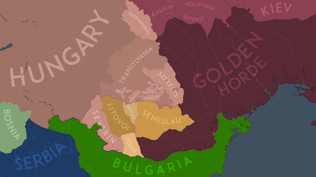
English: The political situation in the Carpathian Basin in the year 1246AD before the Diploma of the Joannites took effect. |
| Datum | |
| Quelle | Eigenes Werk |
| Urheber | NeimWiki |
Lizenz
Ich, der Urheber dieses Werkes, veröffentliche es unter der folgenden Lizenz:
Diese Datei ist lizenziert unter der Creative-Commons-Lizenz „Namensnennung – Weitergabe unter gleichen Bedingungen 4.0 international“.
- Dieses Werk darf von dir
- verbreitet werden – vervielfältigt, verbreitet und öffentlich zugänglich gemacht werden
- neu zusammengestellt werden – abgewandelt und bearbeitet werden
- Zu den folgenden Bedingungen:
- Namensnennung – Du musst angemessene Urheber- und Rechteangaben machen, einen Link zur Lizenz beifügen und angeben, ob Änderungen vorgenommen wurden. Diese Angaben dürfen in jeder angemessenen Art und Weise gemacht werden, allerdings nicht so, dass der Eindruck entsteht, der Lizenzgeber unterstütze gerade dich oder deine Nutzung besonders.
- Weitergabe unter gleichen Bedingungen – Wenn du das Material wiedermischst, transformierst oder darauf aufbaust, musst du deine Beiträge unter der gleichen oder einer kompatiblen Lizenz wie das Original verbreiten.
Dateiversionen
Klicke auf einen Zeitpunkt, um diese Version zu laden.
| Version vom | Vorschaubild | Maße | Benutzer | Kommentar | |
|---|---|---|---|---|---|
| aktuell | 20:44, 19. Feb. 2024 | | 3.445 × 1.937 (525 KB) | NeimWiki | Changed Macso to be included in Hungary, since it was mentioned as Princess Margaret's domain (Bela III's daughter |
| 18:50, 11. Aug. 2023 |  | 3.445 × 1.937 (527 KB) | NeimWiki | Changed the outline of autonomies. | |
| 19:40, 15. Jul. 2023 |  | 3.445 × 1.937 (520 KB) | NeimWiki | Readded the de jure vassal outline of the Banate of Severin and its dependent Vlach knezates. | |
| 11:02, 4. Jun. 2023 |  | 3.445 × 1.937 (514 KB) | NeimWiki | Redid the Wallachian northern border. | |
| 11:30, 19. Apr. 2023 |  | 3.445 × 1.937 (520 KB) | NeimWiki | Updated Maramures. | |
| 17:29, 18. Apr. 2023 |  | 3.445 × 1.937 (520 KB) | NeimWiki | Touched it up a bit. | |
| 17:44, 11. Dez. 2022 |  | 3.445 × 1.937 (518 KB) | NeimWiki | Made the map more detailed. | |
| 17:04, 13. Mai 2022 |  | 3.445 × 1.937 (568 KB) | NeimWiki | Changed the name of the Mongols to Golden Horde. | |
| 16:52, 13. Mai 2022 |  | 3.445 × 1.937 (548 KB) | NeimWiki | A more accurate representation of the borders. | |
| 19:48, 3. Sep. 2021 |  | 3.445 × 1.937 (542 KB) | NeimWiki | A more accurate representation of the borders and provinces. |
Dateiverwendung
Die folgende Seite verwendet diese Datei:
Globale Dateiverwendung
Die nachfolgenden anderen Wikis verwenden diese Datei:
- Verwendung auf en.wikipedia.org
- Verwendung auf mk.wikipedia.org
- Verwendung auf ro.wikipedia.org
- Verwendung auf uk.wikipedia.org