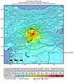
Datei:2020-01-24 Doganyol, Turkey M6.7 earthquake shakemap (USGS).jpg

Größe dieser Vorschau: 539 × 599 Pixel. Weitere Auflösungen: 216 × 240 Pixel | 432 × 480 Pixel | 911 × 1.013 Pixel
Originaldatei (911 × 1.013 Pixel, Dateigröße: 435 KB, MIME-Typ: image/jpeg)
Dateiversionen
Klicke auf einen Zeitpunkt, um diese Version zu laden.
| Version vom | Vorschaubild | Maße | Benutzer | Kommentar | |
|---|---|---|---|---|---|
| aktuell | 21:03, 21. Feb. 2020 |  | 911 × 1.013 (435 KB) | Cewbot | Import USGS updated earthquake map, shakemap id: urn:usgs-product:us:shakemap:us60007ewc:1582308229093 (2020-02-21T18:03:49.093Z) |
| 01:04, 7. Feb. 2020 |  | 911 × 1.013 (435 KB) | Cewbot | Import USGS updated earthquake map, shakemap id: urn:usgs-product:us:shakemap:us60007ewc:1581030619172 (2020-02-06T23:10:19.172Z) | |
| 19:04, 28. Jan. 2020 |  | 906 × 1.013 (433 KB) | Cewbot | Import USGS updated earthquake map, shakemap id: urn:usgs-product:us:shakemap:us60007ewc:1580232131610 (2020-01-28T17:22:11.610Z) | |
| 19:04, 25. Jan. 2020 |  | 917 × 1.027 (436 KB) | Cewbot | Import USGS updated earthquake map, shakemap id: urn:usgs-product:us:shakemap:us60007ewc:1579975084093 (2020-01-25T17:58:04.093Z) | |
| 03:03, 25. Jan. 2020 |  | 923 × 1.026 (437 KB) | Cewbot | Import USGS updated earthquake map, shakemap id: urn:usgs-product:us:shakemap:us60007ewc:1579914243380 (2020-01-25T01:04:03.380Z) | |
| 23:04, 24. Jan. 2020 |  | 923 × 1.026 (436 KB) | Cewbot | Import USGS updated earthquake map, shakemap id: urn:usgs-product:us:shakemap:us60007ewc:1579896098266 (2020-01-24T20:01:38.266Z) | |
| 21:03, 24. Jan. 2020 |  | 923 × 1.026 (436 KB) | Cewbot | Import USGS earthquake map, shakemap id: urn:usgs-product:us:shakemap:us60007ewc:1579895873574 (2020-01-24T19:57:53.574Z) |
Dateiverwendung
Die folgende Seite verwendet diese Datei:
Globale Dateiverwendung
Die nachfolgenden anderen Wikis verwenden diese Datei:
- Verwendung auf cs.wikipedia.org
- Verwendung auf es.wikipedia.org
