Datei:Antarctic Peninsula location map.svg

Größe der PNG-Vorschau dieser SVG-Datei: 388 × 600 Pixel. Weitere aus SVG automatisch erzeugte PNG-Grafiken in verschiedenen Auflösungen: 155 × 240 Pixel | 310 × 480 Pixel | 497 × 768 Pixel | 662 × 1.024 Pixel | 1.325 × 2.048 Pixel | 1.687 × 2.608 Pixel
Originaldatei (SVG-Datei, Basisgröße: 1.687 × 2.608 Pixel, Dateigröße: 551 KB)
![]()
Diese Datei und die Informationen unter dem roten Trennstrich werden aus dem zentralen Medienarchiv Wikimedia Commons eingebunden.
![]()
Beschreibung
| Beschreibung |
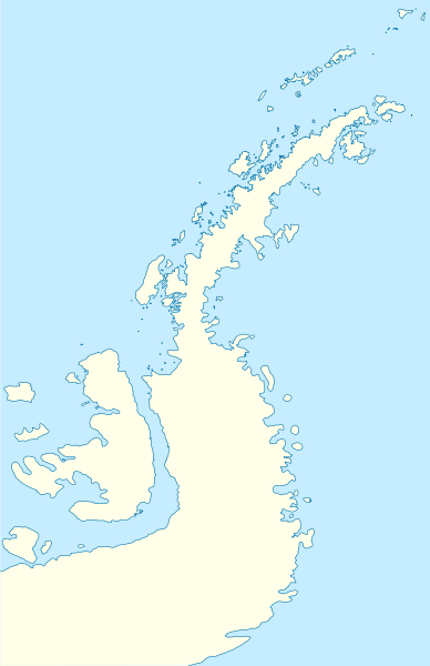
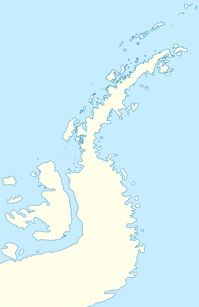
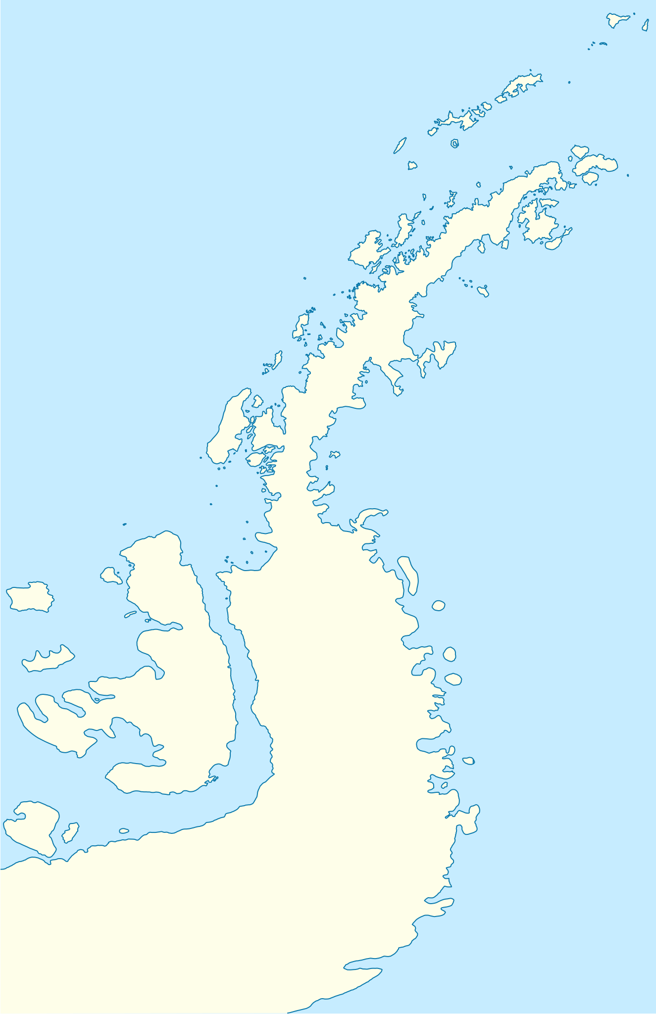
Deutsch: Positionskarte der Antarktischen Halbinsel
Quadratische Plattkarte, N-S-Streckung 230 %. Geographische Begrenzung der Karte:
English: Location map of the Antarctic Peninsula
Equirectangular projection, N/S stretching 230 %. Geographic limits of the map:
|
||
| Datum | |||
| Quelle | own work, using United States National Imagery and Mapping Agency data | ||
| Urheber | NordNordWest |

Lizenz
Ich, der Urheberrechtsinhaber dieses Werkes, veröffentliche es hiermit unter der folgenden Lizenz:

|
Es ist erlaubt, die Datei unter den Bedingungen der GNU-Lizenz für freie Dokumentation, Version 1.2 oder einer späteren Version, veröffentlicht von der Free Software Foundation, zu kopieren, zu verbreiten und/oder zu modifizieren; es gibt keine unveränderlichen Abschnitte, keinen vorderen und keinen hinteren Umschlagtext.
Der vollständige Text der Lizenz ist im Kapitel GNU-Lizenz für freie Dokumentation verfügbar. |
Diese Datei ist unter der Creative-Commons-Lizenz „Namensnennung 3.0 nicht portiert“ lizenziert.
- Dieses Werk darf von dir
- verbreitet werden – vervielfältigt, verbreitet und öffentlich zugänglich gemacht werden
- neu zusammengestellt werden – abgewandelt und bearbeitet werden
- Zu den folgenden Bedingungen:
- Namensnennung – Du musst angemessene Urheber- und Rechteangaben machen, einen Link zur Lizenz beifügen und angeben, ob Änderungen vorgenommen wurden. Diese Angaben dürfen in jeder angemessenen Art und Weise gemacht werden, allerdings nicht so, dass der Eindruck entsteht, der Lizenzgeber unterstütze gerade dich oder deine Nutzung besonders.
Du darfst es unter einer der obigen Lizenzen deiner Wahl verwenden.
Dateiversionen
Klicke auf einen Zeitpunkt, um diese Version zu laden.
| Version vom | Vorschaubild | Maße | Benutzer | Kommentar | |
|---|---|---|---|---|---|
| aktuell | 08:50, 31. Mär. 2009 | | 1.687 × 2.608 (551 KB) | NordNordWest | corr |
| 09:22, 30. Mär. 2009 |  | 1.684 × 2.608 (550 KB) | NordNordWest | corr | |
| 09:04, 30. Mär. 2009 |  | 1.684 × 2.608 (551 KB) | NordNordWest | {{Information |Description= {{de|Positionskarte der Antarktischen Halbinsel}} Quadratische Plattkarte, N-S-Streckung 230 %. Geographische Begrenzung der Karte: * N: 60.8° S * S: 76.0° S * W: 73.6° W * O: 54.8° W {{en|Loc |
Dateiverwendung
Die folgende Seite verwendet diese Datei:
Globale Dateiverwendung
Die nachfolgenden anderen Wikis verwenden diese Datei:
- Verwendung auf ar.wikipedia.org
- Verwendung auf ba.wikipedia.org
- Verwendung auf bg.wikipedia.org
- Гринуич (остров)
- Берое (хълм)
- Якоруда (ледник)
- Шаблон:ПК Антарктически полуостров
- Неговански камък
- Абрит (нунатак)
- Агалина (ледник)
- Алдомировски хребет
- Алтимир (ледник)
- Алцек (нунатак)
- Райна Касабова (ледник)
- Ами Буе (връх)
- Андреев нунатак
- Антонов връх
- Армира (ледник)
- Ариплери (проток)
- Юндола (залив)
- Чубра (връх)
- Чернопеев (връх)
- Цончо Чапанов (връх)
- Чакъров връх
- Хохщетер (връх)
- Димитров (залив)
- Додунеков връх
- Алексиев (ледник)
- Пърличев (хребет)
- Злокучене (ледник)
- Зверино (остров)
- Бона Мансио (остров)
- Verwendung auf ceb.wikipedia.org
- Verwendung auf da.wikipedia.org
- Verwendung auf en.wikipedia.org
- Petermann Island
- Antarctic Sound
- Bridgeman Island (South Shetland Islands)
- Gibbs Island (South Shetland Islands)
- Penguin Island (South Shetland Islands)
- Liège Island
- Charcot Island
- Danco Island
- Lecointe Island
- Mikkelsen Islands
- Latady Island
- Wiencke Island
- Millerand Island
- Trinity Island
- Rowett Island (South Shetland Islands)
Weitere globale Verwendungen dieser Datei anschauen.