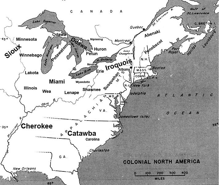
Datei:Beaver wars map.jpg

Größe dieser Vorschau: 710 × 600 Pixel. Weitere Auflösungen: 284 × 240 Pixel | 568 × 480 Pixel | 871 × 736 Pixel
Originaldatei (871 × 736 Pixel, Dateigröße: 163 KB, MIME-Typ: image/jpeg)
Dateiversionen
Klicke auf einen Zeitpunkt, um diese Version zu laden.
| Version vom | Vorschaubild | Maße | Benutzer | Kommentar | |
|---|---|---|---|---|---|
| aktuell | 23:34, 18. Nov. 2008 |  | 871 × 736 (163 KB) | Charles Edward | Slight adjustment to name on image |
| 23:33, 18. Nov. 2008 |  | 871 × 736 (164 KB) | Charles Edward | {{Information |Description=adjustment of locations per discussion on Beaver War talk page |Source= |Date= |Author= |Permission= |other_versions= }} | |
| 20:51, 16. Nov. 2008 |  | 871 × 736 (298 KB) | Charles Edward | {{Information |Description=New version removes borders, ads more ambiguity to the map |Source= |Date= |Author= |Permission= |other_versions= }} | |
| 03:43, 16. Nov. 2008 |  | 815 × 472 (275 KB) | Charles Edward | {{Information |Description= |Source= |Date= |Author= |Permission= |other_versions= }} | |
| 02:16, 16. Nov. 2008 |  | 815 × 472 (275 KB) | Charles Edward | {{Information |Description=adding tribes, adjusting locations |Source= |Date= |Author= |Permission= |other_versions= }} Category:Maps of the United States | |
| 01:39, 16. Nov. 2008 |  | 815 × 472 (270 KB) | Charles Edward | {{Information |Description=Added additional tribes |Source= |Date= |Author= |Permission= |other_versions= }} | |
| 01:35, 16. Nov. 2008 |  | 815 × 472 (270 KB) | Charles Edward | {{Information |Description=Added additional tribes |Source= |Date= |Author= |Permission= |other_versions= }} | |
| 01:14, 16. Nov. 2008 |  | 815 × 472 (262 KB) | Charles Edward | {{Information |Description={{en|1=Map of the location of major tribes involved in the Beaver Wars laid against a period map showing colonial settlments}} |Source=Own work by uploader |Author=Charles Edward |Date=11-15-8 |Permission |
Dateiverwendung
Die folgende Seite verwendet diese Datei:
Globale Dateiverwendung
Die nachfolgenden anderen Wikis verwenden diese Datei:
- Verwendung auf azb.wikipedia.org
- Verwendung auf cs.wikipedia.org
- Verwendung auf en.wikipedia.org
- Verwendung auf es.wikipedia.org
- Verwendung auf et.wikipedia.org
- Verwendung auf gl.wikipedia.org
- Verwendung auf id.wikipedia.org
- Verwendung auf it.wikipedia.org
- Verwendung auf ja.wikipedia.org
- Verwendung auf lv.wikipedia.org
- Verwendung auf nl.wikipedia.org
- Verwendung auf no.wikipedia.org
- Verwendung auf pl.wikipedia.org