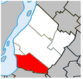
Datei:Brossard Quebec location diagram.PNG
Brossard_Quebec_location_diagram.PNG (329 × 315 Pixel, Dateigröße: 36 KB, MIME-Typ: image/png)
Dateiversionen
Klicke auf einen Zeitpunkt, um diese Version zu laden.
| Version vom | Vorschaubild | Maße | Benutzer | Kommentar | |
|---|---|---|---|---|---|
| aktuell | 17:58, 4. Jul. 2023 |  | 329 × 315 (36 KB) | Roncanada | Correction to Longueuil's border |
| 01:59, 27. Apr. 2009 |  | 325 × 315 (37 KB) | Gordalmighty | map outline correction | |
| 04:17, 25. Apr. 2009 |  | 325 × 315 (38 KB) | Gordalmighty | {{Information |Description={{en|1=Location of Brossard, Quebec within the Urban Agglomeration of Longueuil.}} |Source=Own work by uploader |Author=Gordalmighty |Date=2009-04-24 |Permission= |other_versions= }} <!--{{ImageUpload|full |
Dateiverwendung
Die folgende Seite verwendet diese Datei:
Globale Dateiverwendung
Die nachfolgenden anderen Wikis verwenden diese Datei:
- Verwendung auf ar.wikipedia.org
- Verwendung auf diq.wikipedia.org
- Verwendung auf en.wikipedia.org
- Verwendung auf eo.wikipedia.org
- Verwendung auf es.wikipedia.org
- Verwendung auf fa.wikipedia.org
- Verwendung auf fr.wikipedia.org
- Verwendung auf fr.wikinews.org
- Verwendung auf hak.wikipedia.org
- Verwendung auf ja.wikipedia.org
- Verwendung auf ko.wikipedia.org
- Verwendung auf vo.wikipedia.org
- Verwendung auf www.wikidata.org
- Verwendung auf zh.wikipedia.org