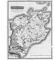
Datei:Caithness Shire 1822 parish map.jpg

Größe dieser Vorschau: 487 × 599 Pixel. Weitere Auflösungen: 195 × 240 Pixel | 390 × 480 Pixel | 624 × 768 Pixel | 832 × 1.024 Pixel | 1.664 × 2.048 Pixel | 6.656 × 8.192 Pixel
Originaldatei (6.656 × 8.192 Pixel, Dateigröße: 14,53 MB, MIME-Typ: image/jpeg)
Dateiversionen
Klicke auf einen Zeitpunkt, um diese Version zu laden.
| Version vom | Vorschaubild | Maße | Benutzer | Kommentar | |
|---|---|---|---|---|---|
| aktuell | 13:33, 28. Okt. 2019 |  | 6.656 × 8.192 (14,53 MB) | Pemu | Harvested again with [https://commonsarchive.wmflabs.org/wiki/File:Create_Stitch_Script_V2.ods Create Stitch Script V2.ods] from https://stataccscot.edina.ac.uk/data/thomson-county-maps/tiles/74400135/5/3/0.jpg … https://stataccscot.edina.ac.uk/data/thomson-county-maps/tiles/74400135/5/28/31.jpg The three leftmost tiles (only plain white) has been left out. |
| 13:29, 28. Okt. 2019 |  | 256 × 256 (20 KB) | Pemu | Tile from the somewhere in the middle | |
| 13:28, 28. Okt. 2019 |  | 256 × 256 (478 Bytes) | Pemu | Tile from top-left (0,0). Seems to be bw? | |
| 20:40, 27. Okt. 2019 |  | 7.424 × 8.192 (13,65 MB) | Pemu | Harvested with [https://commonsarchive.wmflabs.org/wiki/File:Create_Stitch_Script_V2.ods Create Stitch Script V2.ods] from https://stataccscot.edina.ac.uk/data/thomson-county-maps/tiles/74400135/5/0/0.jpg … https://stataccscot.edina.ac.uk/data/thomson-county-maps/tiles/74400135/5/28/31.jpg | |
| 19:38, 27. Okt. 2019 |  | 778 × 1.000 (312 KB) | Ratzer | User created page with UploadWizard |
Dateiverwendung
Die folgende Seite verwendet diese Datei: