Datei:Colombia Providencia Island location map.svg

Größe der PNG-Vorschau dieser SVG-Datei: 429 × 599 Pixel. Weitere aus SVG automatisch erzeugte PNG-Grafiken in verschiedenen Auflösungen: 172 × 240 Pixel | 344 × 480 Pixel | 550 × 768 Pixel | 734 × 1.024 Pixel | 1.467 × 2.048 Pixel | 1.044 × 1.457 Pixel
Originaldatei (SVG-Datei, Basisgröße: 1.044 × 1.457 Pixel, Dateigröße: 52 KB)
![]()
Diese Datei und die Informationen unter dem roten Trennstrich werden aus dem zentralen Medienarchiv Wikimedia Commons eingebunden.
![]()
Beschreibung
| Beschreibung |
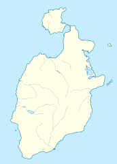
English: Location map of Providencia
Equirectangular projection. Geographic limits of the map:
Español: Mapa localizador de la isla de Providencia |
| Datum | |
| Quelle | Eigenes Werk |
| Urheber | Milenioscuro |
| Andere Versionen |
|
.svg)
Lizenz
Ich, der Urheber dieses Werkes, veröffentliche es unter der folgenden Lizenz:
Diese Datei ist unter der Creative-Commons-Lizenz „Namensnennung – Weitergabe unter gleichen Bedingungen 3.0 nicht portiert“ lizenziert.
- Dieses Werk darf von dir
- verbreitet werden – vervielfältigt, verbreitet und öffentlich zugänglich gemacht werden
- neu zusammengestellt werden – abgewandelt und bearbeitet werden
- Zu den folgenden Bedingungen:
- Namensnennung – Du musst angemessene Urheber- und Rechteangaben machen, einen Link zur Lizenz beifügen und angeben, ob Änderungen vorgenommen wurden. Diese Angaben dürfen in jeder angemessenen Art und Weise gemacht werden, allerdings nicht so, dass der Eindruck entsteht, der Lizenzgeber unterstütze gerade dich oder deine Nutzung besonders.
- Weitergabe unter gleichen Bedingungen – Wenn du das Material wiedermischst, transformierst oder darauf aufbaust, musst du deine Beiträge unter der gleichen oder einer kompatiblen Lizenz wie das Original verbreiten.
Dateiversionen
Klicke auf einen Zeitpunkt, um diese Version zu laden.
| Version vom | Vorschaubild | Maße | Benutzer | Kommentar | |
|---|---|---|---|---|---|
| aktuell | 10:12, 26. Mai 2015 | | 1.044 × 1.457 (52 KB) | Milenioscuro | border |
| 10:03, 22. Aug. 2012 |  | 1.044 × 1.457 (61 KB) | Milenioscuro | lakes | |
| 09:55, 22. Aug. 2012 |  | 1.044 × 1.457 (61 KB) | Milenioscuro | correction of the outline, according to official maps and tourist maps | |
| 02:31, 27. Dez. 2011 |  | 291 × 406 (26 KB) | Milenioscuro | layers, borders | |
| 06:57, 2. Jul. 2011 |  | 292 × 407 (22 KB) | Milenioscuro | {{Information |Description ={{en|1=Location map of Providencia Island}} {{es|1=Mapa localizador de la isla de Providencia}} |Source ={{own}} |Author =Shadowxfox |Date =2011-07-02 |
Dateiverwendung
Die folgenden 2 Seiten verwenden diese Datei:
Globale Dateiverwendung
Die nachfolgenden anderen Wikis verwenden diese Datei:
- Verwendung auf arz.wikipedia.org
- Verwendung auf az.wikipedia.org
- Verwendung auf ba.wikipedia.org
- Verwendung auf ca.wikipedia.org
- Verwendung auf en.wikipedia.org
- Verwendung auf es.wikipedia.org
- Verwendung auf fa.wikipedia.org
- Verwendung auf fr.wikipedia.org
- Verwendung auf gl.wikipedia.org
- Verwendung auf he.wikipedia.org
- Verwendung auf ja.wikipedia.org
- Verwendung auf ru.wikipedia.org
- Verwendung auf si.wikipedia.org
- Verwendung auf tr.wikipedia.org
- Verwendung auf uk.wikipedia.org
- Verwendung auf uz.wikipedia.org
- Verwendung auf www.wikidata.org