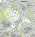
Datei:Datteln Gliederung.png

Größe dieser Vorschau: 565 × 599 Pixel. Weitere Auflösungen: 226 × 240 Pixel | 452 × 480 Pixel | 724 × 768 Pixel | 965 × 1.024 Pixel | 1.930 × 2.048 Pixel | 5.248 × 5.568 Pixel
Originaldatei (5.248 × 5.568 Pixel, Dateigröße: 35,21 MB, MIME-Typ: image/png)
Dateiversionen
Klicke auf einen Zeitpunkt, um diese Version zu laden.
| Version vom | Vorschaubild | Maße | Benutzer | Kommentar | |
|---|---|---|---|---|---|
| aktuell | 18:13, 10. Apr. 2022 |  | 5.248 × 5.568 (35,21 MB) | Elop | |
| 16:30, 25. Mär. 2022 |  | 5.248 × 5.568 (35 MB) | Elop | ||
| 16:01, 23. Mär. 2022 |  | 5.248 × 5.568 (34,99 MB) | Elop | ||
| 11:49, 13. Mär. 2022 |  | 2.624 × 2.784 (11,91 MB) | Elop | ||
| 11:51, 18. Feb. 2022 |  | 2.624 × 2.784 (11,95 MB) | Elop | ||
| 14:31, 16. Feb. 2022 |  | 2.624 × 2.784 (11,95 MB) | Elop | ||
| 20:14, 15. Feb. 2022 |  | 2.624 × 2.784 (11,94 MB) | Elop | ||
| 16:25, 12. Feb. 2022 |  | 2.624 × 2.784 (12,84 MB) | Elop | ||
| 19:41, 10. Feb. 2022 |  | 2.624 × 2.784 (12,82 MB) | Elop | ||
| 19:38, 10. Feb. 2022 |  | 2.624 × 2.784 (12,82 MB) | Elop | == {{int:filedesc}} == {{Information |Description ={{de|1= Topographische Karte zur Stadtgliederung Dattelns }} |Source ={{own}} |Author =Elop, Background: [https://opentopomap.org/#marker=13/51.65252/7.34240 OpenTopoMap], OTM-Kacheln von 2020 |Date =2022-02-10 |Permission = |other_versions = siehe Galerie }} == {{int:license-header}} == {{self|cc-b... |
Dateiverwendung
Die folgende Seite verwendet diese Datei: