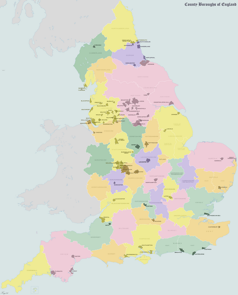
Datei:England County Boroughs 1974.png

Größe dieser Vorschau: 483 × 599 Pixel. Weitere Auflösungen: 193 × 240 Pixel | 387 × 480 Pixel | 619 × 768 Pixel | 825 × 1.024 Pixel | 1.651 × 2.048 Pixel | 2.625 × 3.256 Pixel
Originaldatei (2.625 × 3.256 Pixel, Dateigröße: 1,06 MB, MIME-Typ: image/png)
Dateiversionen
Klicke auf einen Zeitpunkt, um diese Version zu laden.
| Version vom | Vorschaubild | Maße | Benutzer | Kommentar | |
|---|---|---|---|---|---|
| aktuell | 15:09, 29. Aug. 2024 |  | 2.625 × 3.256 (1,06 MB) | XrysD | Made Stockport wholly within Cheshire. Moved Warley to Worcs. Other small changes to boundaries. Updated sea and land colour to improve contrast. Added NI, |
| 19:49, 7. Mai 2011 |  | 2.625 × 3.256 (1,12 MB) | XrysD | Moved Dudley from Worcs to Staffs | |
| 11:27, 21. Aug. 2010 |  | 2.625 × 3.256 (1,12 MB) | XrysD | {{Information |Description={{en|1=Map of the County Boroughs of England in 1974}} |Source={{own}} |Author=XrysD |Date=21-08-2010 |Permission= |other_versions= }} |
Dateiverwendung
Die folgende Seite verwendet diese Datei:
Globale Dateiverwendung
Die nachfolgenden anderen Wikis verwenden diese Datei:
- Verwendung auf en.wikipedia.org
- Verwendung auf et.wikipedia.org
- Verwendung auf fa.wikipedia.org
- Verwendung auf fr.wikipedia.org
- Verwendung auf uk.wikipedia.org
- Verwendung auf www.wikidata.org
