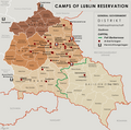
Datei:General Government camps of Lublin Reservation.png

Größe dieser Vorschau: 605 × 600 Pixel. Weitere Auflösungen: 242 × 240 Pixel | 484 × 480 Pixel | 774 × 768 Pixel | 1.033 × 1.024 Pixel | 2.299 × 2.280 Pixel
Originaldatei (2.299 × 2.280 Pixel, Dateigröße: 636 KB, MIME-Typ: image/png)
Dateiversionen
Klicke auf einen Zeitpunkt, um diese Version zu laden.
| Version vom | Vorschaubild | Maße | Benutzer | Kommentar | |
|---|---|---|---|---|---|
| aktuell | 18:14, 3. Mai 2018 |  | 2.299 × 2.280 (636 KB) | Poeticbent | added location of Kulmhof to map & legend |
| 18:10, 17. Apr. 2016 |  | 2.299 × 2.280 (620 KB) | Poeticbent | added missing locations | |
| 05:35, 15. Apr. 2016 |  | 2.299 × 2.280 (609 KB) | Poeticbent | =={{int:filedesc}}== {{Information |description={{en|1=Map of the administrative areas of the General Government}} |date=2012-05-26 |source={{own}} by {{u|XrysD}}, edited by {{u|Poeticbent}} with superimposed camps of Lublin Reservation before and afte... |
Dateiverwendung
Die folgende Seite verwendet diese Datei:
Globale Dateiverwendung
Die nachfolgenden anderen Wikis verwenden diese Datei:
- Verwendung auf el.wikipedia.org
- Verwendung auf en.wikipedia.org
- Verwendung auf es.wikipedia.org
- Verwendung auf fa.wikipedia.org
- Verwendung auf fr.wikipedia.org
- Verwendung auf it.wikipedia.org
- Verwendung auf no.wikipedia.org
- Verwendung auf pl.wikipedia.org
- Verwendung auf zh.wikipedia.org
