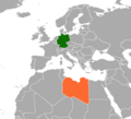
Datei:Germany Libya Locator.png

Größe dieser Vorschau: 659 × 600 Pixel. Weitere Auflösungen: 264 × 240 Pixel | 527 × 480 Pixel | 844 × 768 Pixel | 1.160 × 1.056 Pixel
Originaldatei (1.160 × 1.056 Pixel, Dateigröße: 80 KB, MIME-Typ: image/png)
Dateiversionen
Klicke auf einen Zeitpunkt, um diese Version zu laden.
| Version vom | Vorschaubild | Maße | Benutzer | Kommentar | |
|---|---|---|---|---|---|
| aktuell | 02:08, 30. Okt. 2020 |  | 1.160 × 1.056 (80 KB) | Aquintero82 | Updated map |
| 05:08, 31. Mär. 2020 |  | 628 × 1.064 (52 KB) | Aquintero82 | Updated map | |
| 11:26, 8. Mai 2009 |  | 1.357 × 628 (46 KB) | FeydHuxtable~commonswiki | Reverted to version as of 10:23, 8 May 2009 | |
| 11:25, 8. Mai 2009 |  | 1.357 × 628 (46 KB) | FeydHuxtable~commonswiki | exspanded map that should display better | |
| 11:23, 8. Mai 2009 |  | 1.357 × 628 (46 KB) | FeydHuxtable~commonswiki | trying again to get an image that displays nicely! | |
| 11:07, 8. Mai 2009 |  | 1.126 × 844 (27 KB) | FeydHuxtable~commonswiki | reloading larger size as still not displaying well | |
| 10:52, 8. Mai 2009 |  | 1.024 × 768 (21 KB) | FeydHuxtable~commonswiki | reloading a larger version of same image as it didnt display nicely. | |
| 10:44, 8. Mai 2009 |  | 512 × 384 (8 KB) | FeydHuxtable~commonswiki | {{Information |Description={{en|1=a map showing the locations of Germany and Libya, created by me using existing public domain map as a template.}} |Source=based on Armenia USA Locator.png, modified by me |Author=FeydHuxtable |Date=2 |
Dateiverwendung
Die folgende Seite verwendet diese Datei:
Globale Dateiverwendung
Die nachfolgenden anderen Wikis verwenden diese Datei:
- Verwendung auf en.wikipedia.org
- Verwendung auf he.wikipedia.org
- Verwendung auf ru.wikipedia.org