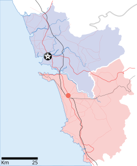
Datei:Goa locator map.svg

Größe der PNG-Vorschau dieser SVG-Datei: 274 × 331 Pixel. Weitere aus SVG automatisch erzeugte PNG-Grafiken in verschiedenen Auflösungen: 199 × 240 Pixel | 397 × 480 Pixel | 636 × 768 Pixel | 848 × 1.024 Pixel | 1.695 × 2.048 Pixel
Originaldatei (SVG-Datei, Basisgröße: 274 × 331 Pixel, Dateigröße: 93 KB)
Dateiversionen
Klicke auf einen Zeitpunkt, um diese Version zu laden.
| Version vom | Vorschaubild | Maße | Benutzer | Kommentar | |
|---|---|---|---|---|---|
| aktuell | 11:48, 26. Apr. 2007 |  | 274 × 331 (93 KB) | Planemad | upd |
| 11:40, 26. Apr. 2007 |  | 274 × 331 (80 KB) | Planemad | upd | |
| 19:27, 9. Apr. 2007 |  | 274 × 331 (66 KB) | Planemad | {{WikiProject_India_Maps |Title=Goa locator map |Description=Locator map for the state of [w:Goa]] |Source= [http://www.bombayproperty.com/goamap.jpg Map of Goa], |Date=April 2007 |Author=w:user:Planemad }} Category:WikiProject India State Maps |
Dateiverwendung
Die folgende Seite verwendet diese Datei:
Globale Dateiverwendung
Die nachfolgenden anderen Wikis verwenden diese Datei:
- Verwendung auf ar.wikipedia.org
- Verwendung auf ba.wikipedia.org
- Verwendung auf ceb.wikipedia.org
- Verwendung auf cy.wikipedia.org
- Verwendung auf en.wikipedia.org
- Farmagudi
- Zuari River
- Pilar, Goa
- Bardez taluka
- Sonsogor
- Flora and fauna of Goa
- Sanguem
- Mollem, Goa
- Dabolim
- Template:Goa-geo-stub
- Aquem
- Bambolim
- Bandora, Goa
- Canacona
- Carapur
- Chicalim
- Chimbel
- Colvale
- Curti, Goa
- Davorlim
- Parcem
- Penha de França, Goa
- Queula
- Sancoale
- Sanquelim
- Sanvordem
- São José de Areal
- Valpoi
- Arpora
- Altinho, Goa
- Mardol, Goa
- Gokarna Math
- Baga, Goa
- Baga Creek
- Chapora Beach
- Terekhol River
- Kasarpal
- Revora
- Pale, Goa
- Agaçaim
- Priol
- Betul, Goa
- Bogmalo
- Adas Bank
- St Inez Creek
- Caranzalem
Weitere globale Verwendungen dieser Datei anschauen.