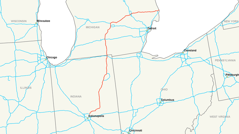
Datei:Interstate 69 map.png

Größe dieser Vorschau: 800 × 450 Pixel. Weitere Auflösungen: 320 × 180 Pixel | 640 × 360 Pixel | 1.024 × 575 Pixel | 1.280 × 719 Pixel | 2.205 × 1.239 Pixel
Originaldatei (2.205 × 1.239 Pixel, Dateigröße: 119 KB, MIME-Typ: image/png)
Dateiversionen
Klicke auf einen Zeitpunkt, um diese Version zu laden.
| Version vom | Vorschaubild | Maße | Benutzer | Kommentar | |
|---|---|---|---|---|---|
| aktuell | 11:00, 26. Nov. 2015 |  | 2.205 × 1.239 (119 KB) | Imzadi1979 (public) | Reverted to version as of 05:15, 16 July 2006 (UTC) |
| 10:46, 26. Nov. 2015 |  | 798 × 1.084 (54 KB) | BasilLeaf | The map File:Interstate 69 map.png already exists under the name File:I69--Michigan-Indiana.png, and the name '''File:Interstate 69 map.png''' is the generic '''File:Interstate # map.png''' associated with the infobox used in these articles,... | |
| 06:00, 26. Nov. 2015 |  | 2.205 × 1.239 (119 KB) | Imzadi1979 | Reverted to version as of 05:15, 16 July 2006 (UTC); restoring original, upload any new maps under a new title please | |
| 04:47, 26. Nov. 2015 |  | 798 × 1.084 (54 KB) | BasilLeaf | full map | |
| 06:15, 16. Jul. 2006 |  | 2.205 × 1.239 (119 KB) | Stratosphere | {{Information| |Description=Map of Interstate 69 |Source=Own Work |Date=July 15, 2006 |Author=Nick Nolte |Permission=Own work, all rights released (Public domain) |other_versions= }} {{PD-self}} Category:U.S. Interstate Maps[ |
Dateiverwendung
Die folgende Seite verwendet diese Datei:
Globale Dateiverwendung
Die nachfolgenden anderen Wikis verwenden diese Datei:
- Verwendung auf en.wikipedia.org
- Verwendung auf en.wikibooks.org
- Verwendung auf eu.wikipedia.org
- Verwendung auf fa.wikipedia.org
- Verwendung auf it.wikipedia.org
- Verwendung auf ko.wikipedia.org
- Verwendung auf nl.wikipedia.org
- Verwendung auf pt.wikipedia.org
- Verwendung auf ru.wikipedia.org
- Verwendung auf sv.wikipedia.org
- Verwendung auf vi.wikipedia.org
