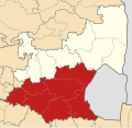
Datei:Map of Mpumalanga with Gert Sibande highlighted (2016).svg

Größe der PNG-Vorschau dieser SVG-Datei: 617 × 599 Pixel. Weitere aus SVG automatisch erzeugte PNG-Grafiken in verschiedenen Auflösungen: 247 × 240 Pixel | 494 × 480 Pixel | 791 × 768 Pixel | 1.054 × 1.024 Pixel | 2.108 × 2.048 Pixel | 768 × 746 Pixel
Originaldatei (SVG-Datei, Basisgröße: 768 × 746 Pixel, Dateigröße: 396 KB)
Dateiversionen
Klicke auf einen Zeitpunkt, um diese Version zu laden.
| Version vom | Vorschaubild | Maße | Benutzer | Kommentar | |
|---|---|---|---|---|---|
| aktuell | 00:46, 11. Sep. 2016 |  | 768 × 746 (396 KB) | Htonl | == {{int:filedesc}} == {{Information |Description ={{en|1=Map of municipal boundaries in w:Mpumalanga, as they are after the municipal elections of 3 August 2016, with the [[w:Gert Sibande District M... |
Dateiverwendung
Die folgende Seite verwendet diese Datei:
Globale Dateiverwendung
Die nachfolgenden anderen Wikis verwenden diese Datei:
- Verwendung auf ru.wikipedia.org
- Verwendung auf zu.wikipedia.org
- Template:Gert Sibande District Municipality
- Ermelo, Mpumalanga
- Gert Sibande District Municipality
- Breyten
- Chrissiesmeer
- Davel
- KwaDela
- Warburton, Mpumalanga
- Sheepmoor
- Lothair, Mpumalanga
- Bethal
- Lebohang, Mpumalanga
- Leslie, Mpumalanga
- Secunda, Mpumalanga
- Trichardt
- Embalenhle
- Evander, Mpumalanga
- Kinross, Mpumalanga
- Leandra, Mpumalanga
- Charl Cilliers, Mpumalanga
- Thuthukani
- Standerton
- Sivukile
- Sakhile, Mpumalanga
- Morgenzon
- Dundonald, Mpumalanga
- Diepgezet
- Diepdale
- Bettysgoed
- Badplaas
- Carolina, Mpumalanga
- Ekulindeni
- Eerstehoek
- Holeka
- Hartebeeskop
- Glenmore, Mpumalanga
- Fernie
- Etjelembube
- Esgwili
- EMbangweni
- Maphundlwane
- Manzana, Mpumalanga
- Manaar
- Lukwatini
- Lochiel, Mpumalanga
- Mooiplaas, Mpumalanga
- Moddergat, Mpumalanga
- Mayflower Gate
- Mayflower, Mpumalanga
Weitere globale Verwendungen dieser Datei anschauen.
