Datei:Map of the Flight of locks at Falkirk.png

Originaldatei (836 × 908 Pixel, Dateigröße: 896 KB, MIME-Typ: image/png)

Diese Datei und die Informationen unter dem roten Trennstrich werden aus dem zentralen Medienarchiv Wikimedia Commons eingebunden.

Zur Beschreibungsseite auf Commons


Beschreibung

Beschreibung
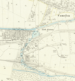
English: Part of OS sheet XXX.2 showing the flight of canal locks at Falkirk and a section of the Antonine Wall between Rough Castle and Camelon at a scale of 1:2,500 or about 25 inches to one mile. Second Edition, 1897
Datum
Quelle
This image is available from the National Library of Scotland
https://maps.nls.uk/geo/explore/side-by-side/#zoom=16&lat=55.99833&lon=-3.81570&layers=168&right=BingHyb
Urheber Director General of the Ordnance Survey, UK

Lizenz

This work is an Ordnance Survey map over 50 years old, which is covered by Crown Copyright which in this case expires 50 years after publication. Ordnance Survey does however ask that they be credited and that the date of publication be given. Any ancillary rights gained through the creation of the electronic version are granted as freely usable under any circumstances.
Public domain
Dieses von der Regierung des Vereinigten Königreichs erstellte Werk ist gemeinfrei.

Dies liegt daran, dass es entweder:

  1. ein Foto ist, das von der Regierung des Vereinigten Königreichs vor dem 1. Juni 1957 erstellt wurde, oder
  2. ein Foto oder eine Gravur ist, das von der Regierung des Vereinigten Königreichs erstellt wurde und vor 1974 kommerziell veröffentlicht wurde, oder
  3. ein Kunstwerk ist, bei dem es sich nicht um ein Foto oder eine Gravur handelt, das von der Regierung des Vereinigten Königreichs vor 1974 erstellt wurde.
HMSO hat erklärt, dass dies weltweit gilt (siehe HMSO-E-Mail).
Weitere Informationen. Siehe auch Urheberrecht and Kunstwerke unter dem Crown copyright (PDF).

Deutsch  English  Español  français  italiano  Nederlands  polski  português  sicilianu  slovenščina  suomi  Türkçe  македонски  русский  українська  മലയാളം  한국어  日本語  简体中文  繁體中文  العربية  +/−

Kurzbeschreibungen

Ergänze eine einzeilige Erklärung, was diese Datei darstellt.

In dieser Datei abgebildete Objekte

Motiv

image/png

Dateiversionen

Klicke auf einen Zeitpunkt, um diese Version zu laden.

Version vomVorschaubildMaßeBenutzerKommentar
aktuell23:28, 30. Mai 2020Vorschaubild der Version vom 23:28, 30. Mai 2020836 × 908 (896 KB)Knipptang=={{int:filedesc}}== {{Information |description={{en|1=Part of OS sheet XXX.2 showing the flight of canal locks at Falkirk and a section of the Antonine Wall between Rough Castle and Camelon at a scale of 1:2,500 or about 25 inches to one mile. Second Edition, 1897}} |date=1897-12-31 |source={{NLS Collections}} https://maps.nls.uk/geo/explore/side-by-side/#zoom=16&lat=55.99833&lon=-3.81570&layers=168&right=BingHyb |author=Director General of the Ordnance Survey, UK |permission= |other version...

Die folgende Seite verwendet diese Datei:

Globale Dateiverwendung

Die nachfolgenden anderen Wikis verwenden diese Datei: