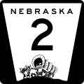
Datei:N-2.svg

Größe der PNG-Vorschau dieser SVG-Datei: 600 × 600 Pixel. Weitere aus SVG automatisch erzeugte PNG-Grafiken in verschiedenen Auflösungen: 240 × 240 Pixel | 480 × 480 Pixel | 768 × 768 Pixel | 1.024 × 1.024 Pixel | 2.048 × 2.048 Pixel
Originaldatei (SVG-Datei, Basisgröße: 600 × 600 Pixel, Dateigröße: 88 KB)
Dateiversionen
Klicke auf einen Zeitpunkt, um diese Version zu laden.
| Version vom | Vorschaubild | Maße | Benutzer | Kommentar | |
|---|---|---|---|---|---|
| aktuell | 05:51, 28. Jul. 2022 |  | 600 × 600 (88 KB) | Smasongarrison | slimmed down with svgomg // Editing SVG source code using c:User:Rillke/SVGedit.js |
| 20:24, 3. Mär. 2012 |  | 600 × 600 (124 KB) | Fredddie | ||
| 08:25, 3. Mär. 2012 |  | 600 × 600 (100 KB) | Fredddie | ||
| 23:42, 4. Okt. 2006 |  | 1.728 × 1.760 (1,35 MB) | Master son | {{Information| |Description=Nebraska state Highway marker. Uses the FHWA font (type D for 1 digit routes, type C for 2d, type 3 for 3d |Source=http://www.nebraskatransportation.org/traffeng/mutcd/m1-3signs.pdf |Date=10/4/2006 |Author=Scott Onson |Permiss | |
| 21:47, 4. Okt. 2006 |  | 1.728 × 1.760 (1,35 MB) | Master son | {{Information| |Description=Nebraska state Highway marker. Uses the FHWA font (type D for 1 digit routes, type C for 2d, type 3 for 3d |Source=http://www.nebraskatransportation.org/traffeng/mutcd/m1-3signs.pdf |Date=10/4/2006 |Author=Scott Onson |Permiss | |
| 18:46, 4. Okt. 2006 |  | 1.728 × 1.760 (1,35 MB) | Master son | {{Information| |Description=Nebraska state Highway marker. Uses the FHWA font (type D for 1 digit routes, type C for 2d, type 3 for 3d |Source=http://www.nebraskatransportation.org/traffeng/mutcd/m1-3signs.pdf |Date=10/4/2006 |Author=Scott Onson |Permiss |
Dateiverwendung
Die folgende Seite verwendet diese Datei:
Globale Dateiverwendung
Die nachfolgenden anderen Wikis verwenden diese Datei:
- Verwendung auf bn.wikipedia.org
- Verwendung auf en.wikipedia.org
- Lancaster County, Nebraska
- Thomas County, Nebraska
- Sioux County, Nebraska
- Sherman County, Nebraska
- Sheridan County, Nebraska
- Otoe County, Nebraska
- Hooker County, Nebraska
- Hamilton County, Nebraska
- Hall County, Nebraska
- Grant County, Nebraska
- Dawes County, Nebraska
- Custer County, Nebraska
- Buffalo County, Nebraska
- Box Butte County, Nebraska
- Blaine County, Nebraska
- Douglas, Nebraska
- U.S. Route 281
- List of highways numbered 2
- Nebraska Highway 50
- User:Stratosphere
- List of crossings of the Missouri River
- Iowa Highway 2
- Brownville Bridge
- Nebraska City Bridge
- Wikipedia:WikiProject U.S. Roads/Nebraska/Userbox
- Plattsmouth Bridge
- Nebraska Highway 1
- Nebraska Highway 92
- Nebraska State Highway System
- Nebraska Highway 2
- Nebraska Highway 4
- Interstate 80 in Nebraska
- Nebraska Highway 67
- Nebraska Highway 10
- Nebraska Highway 11
- U.S. Route 20 in Nebraska
- Nebraska Highway 21
- User:Master son/US Roads/Sub
- Nebraska Highway 27
- Nebraska Highway 43
- U.S. Route 30 in Nebraska
- Nebraska Highway 61
- Nebraska Highway 68
- Nebraska Highway 87
- Nebraska Highway 250
- Nebraska Highway 97
- Nebraska Highway 91
- Nebraska Highway 70
- Nebraska Highway 71
Weitere globale Verwendungen dieser Datei anschauen.
