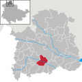
Datei:Nohra in NDH.png
Nohra_in_NDH.png (299 × 299 Pixel, Dateigröße: 8 KB, MIME-Typ: image/png)
Dateiversionen
Klicke auf einen Zeitpunkt, um diese Version zu laden.
| Version vom | Vorschaubild | Maße | Benutzer | Kommentar | |
|---|---|---|---|---|---|
| aktuell | 12:14, 6. Jul. 2018 |  | 299 × 299 (8 KB) | NordNordWest | upd |
| 21:05, 28. Feb. 2012 |  | 299 × 299 (5 KB) | NordNordWest | upd | |
| 14:50, 4. Dez. 2010 |  | 299 × 299 (4 KB) | Rauenstein | ||
| 05:11, 26. Dez. 2009 |  | 299 × 299 (4 KB) | Pomfuttge | bleicherode und obergebra geeint | |
| 01:29, 29. Nov. 2008 |  | 299 × 299 (4 KB) | Rauenstein | {{Information |Description= |Source= |Date= |Author= |Permission= |other_versions= }} | |
| 16:12, 18. Okt. 2007 |  | 299 × 299 (4 KB) | Rauenstein | {{Information |Description=Nohra in Thuringia - District Nordhausen |Source=self |Date=2007-10-18 |Author=own work by Geograv |Permission= {{GFDL}} }} [[Category:Locator maps of municipalities in the Landkr |
Dateiverwendung
Die folgende Seite verwendet diese Datei:
Globale Dateiverwendung
Die nachfolgenden anderen Wikis verwenden diese Datei:
- Verwendung auf es.wikipedia.org
- Verwendung auf eu.wikipedia.org
- Verwendung auf hu.wikipedia.org
- Verwendung auf nl.wikipedia.org
- Verwendung auf pt.wikipedia.org
- Verwendung auf ro.wikipedia.org
- Verwendung auf sh.wikipedia.org
- Verwendung auf sr.wikipedia.org
- Verwendung auf sv.wikipedia.org
- Verwendung auf tt.wikipedia.org
- Verwendung auf uk.wikipedia.org
- Verwendung auf vi.wikipedia.org
- Verwendung auf www.wikidata.org

