Datei:Venezuela - Location Map (2013) - VEN - UNOCHA.svg

Originaldatei (SVG-Datei, Basisgröße: 254 × 254 Pixel, Dateigröße: 336 KB)

Dieses Bild in rendern.

Diese Datei und die Informationen unter dem roten Trennstrich werden aus dem zentralen Medienarchiv Wikimedia Commons eingebunden.

Zur Beschreibungsseite auf Commons


Beschreibung

Beschreibung
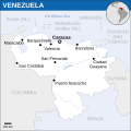
English: Locator map of Venezuela.
Datum
Quelle
Urheber
SVG‑Erstellung
InfoField
 
Der SVG-Code ist valide.
 
Diese Landkarte wurde mit Inkscape erstellt.
 
 Diese Landkarte verwendet Text-Einbettung, die mit einem Texteditor leicht übersetzbar ist.


Lizenz

w:de:Creative Commons
Namensnennung
Diese Datei ist unter der Creative-Commons-Lizenz „Namensnennung 3.0 nicht portiert“ lizenziert.
Namensnennung: OCHA
Dieses Werk darf von dir
  • verbreitet werden – vervielfältigt, verbreitet und öffentlich zugänglich gemacht werden
  • neu zusammengestellt werden – abgewandelt und bearbeitet werden
Zu den folgenden Bedingungen:
  • Namensnennung – Du musst angemessene Urheber- und Rechteangaben machen, einen Link zur Lizenz beifügen und angeben, ob Änderungen vorgenommen wurden. Diese Angaben dürfen in jeder angemessenen Art und Weise gemacht werden, allerdings nicht so, dass der Eindruck entsteht, der Lizenzgeber unterstütze gerade dich oder deine Nutzung besonders.
This map is part of a collection of 216 free country maps, created by the UN Office for the Coordination of Humanitarian Affairs (OCHA), to be used in print, web or broadcast products.

The ReliefWeb Location Maps released here are maps that highlight a country, its capital, major populated places and the surrounding regions.

Attribution Requirements

Using the map without modifications: ensure that the sources and the disclaimer are below the map. Credit as follows: "Credit: OCHA".

For use with alteration: remove the OCHA logo and disclaimer following any modification to the map, but keep the data sources as mentioned below the map. Credit the modified map as follows: "Based on OCHA map". You are responsible for the content of your map.

We are keen to receive your feedback and hear how you used OCHA's maps. We would be grateful if you would notify us by e-mail and share your work with us.

UN Disclaimer
The designations employed and the presentation of material of this map do not imply the expression of any opinion whatsoever on the part of the Secretariat of the United Nations concerning the legal status of any country, territory, city or area or of its authorities or concerning the delimitation of its frontiers or boundaries.

Kurzbeschreibungen

Ergänze eine einzeilige Erklärung, was diese Datei darstellt.

In dieser Datei abgebildete Objekte

Motiv

image/svg+xml

Dateiversionen

Klicke auf einen Zeitpunkt, um diese Version zu laden.

Version vomVorschaubildMaßeBenutzerKommentar
aktuell10:05, 13. Mai 2023Vorschaubild der Version vom 10:05, 13. Mai 2023254 × 254 (336 KB)IllchyFile uploaded using svgtranslate tool (https://svgtranslate.toolforge.org/). Added translation for id.
15:40, 23. Mär. 2019Vorschaubild der Version vom 15:40, 23. Mär. 2019254 × 254 (337 KB)Milenioscurocorrected names
15:34, 23. Mär. 2019Vorschaubild der Version vom 15:34, 23. Mär. 2019254 × 254 (327 KB)MilenioscuroReverted to version as of 01:21, 8 May 2014 (UTC)
15:14, 10. Mär. 2019Vorschaubild der Version vom 15:14, 10. Mär. 2019235 × 235 (296 KB)NutshinouRemove logo and swapped incorrect tags
02:21, 8. Mai 2014Vorschaubild der Version vom 02:21, 8. Mai 2014254 × 254 (327 KB)UN OCHA maps bot== {{int:filedesc}} == {{Information |description={{en|1=Locator map of Venezuela.}} |date=2013 |source={{en|1=[http://reliefweb.int/map/venezuela-bolivarian-republic/venezuela-location-map-2013 Venezuela (Bolivarian Republic of) Loc...

Die folgende Seite verwendet diese Datei:

Globale Dateiverwendung

Die nachfolgenden anderen Wikis verwenden diese Datei:

Metadaten