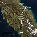
Datei:Via Flaminia map.jpg

Größe dieser Vorschau: 600 × 600 Pixel. Weitere Auflösungen: 240 × 240 Pixel | 480 × 480 Pixel | 1.000 × 1.000 Pixel
Originaldatei (1.000 × 1.000 Pixel, Dateigröße: 635 KB, MIME-Typ: image/jpeg)
Dateiversionen
Klicke auf einen Zeitpunkt, um diese Version zu laden.
| Version vom | Vorschaubild | Maße | Benutzer | Kommentar | |
|---|---|---|---|---|---|
| aktuell | 17:33, 7. Apr. 2008 |  | 1.000 × 1.000 (635 KB) | AlMare | corrected: Ariminum, -Perusia, +Arretium |
| 01:34, 7. Nov. 2006 |  | 1.000 × 1.000 (569 KB) | AlMare | {{en|Map of the Via Flaminia and the later Via Flaminia Nova.}} {{de|Karte der Via Flaminia und der Via Flaminia Nova.}} == Summary == This map is based on the following picture: [[:Image:Satellite image of Italy | |
| 01:25, 7. Nov. 2006 |  | 1.000 × 1.000 (569 KB) | AlMare | {{en|Map of the Via Flaminia and the later Via Flaminia Nova.}} {{de|Karte der Via Flaminia und der Via Flaminia Nova.}} == Summary == This map is based on the following picture: [[:Image:Satellite image of Italy |
Dateiverwendung
Die folgende Seite verwendet diese Datei:
Globale Dateiverwendung
Die nachfolgenden anderen Wikis verwenden diese Datei:
- Verwendung auf be.wikipedia.org
- Verwendung auf he.wikipedia.org
- Verwendung auf hu.wikipedia.org
- Verwendung auf pl.wikipedia.org
- Verwendung auf ru.wikipedia.org
- Verwendung auf sk.wikipedia.org

