| Leuchtturm
|
Standort
|
Verwaltungsregion
|
Positionskordinaten
|
Baujahr
|
Höhe
|
!
|
| Turm
|
Feuer
|
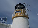
| Ailsa Craig
|
|
Ailsa Craig
|
South Ayrshire
|
55° 15′ 6,8″ N, 5° 6′ 30,3″ W55.251894-5.108418
|
1886
|
|
|
|
| An t-Iasgair
|
Die Wikipedia wünscht sich an dieser Stelle ein Bild vom hier behandelten Ort. Falls du dabei helfen möchtest, erklärt die Anleitung, wie das geht. |
An t-Iasgair
|
Highland
|
57° 41′ 6,5″ N, 6° 25′ 56,8″ W57.685151-6.43245
|
|
|
|
|
| Ardencaple Castle Light
|

|
Helensburgh
|
Argyll and Bute
|
56° 0′ 32,7″ N, 4° 45′ 25″ W56.00908-4.756936
|
|
0 ft (0 m)
|
0 ft (0 m)
|
|
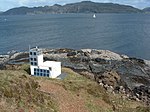
| Ardmore
|
|
nahe
Tobermory
|
Argyll and Bute
|
56° 39′ 21,6″ N, 6° 7′ 42,9″ W56.656002-6.128581
|
|
|
|
|
| Ardnamurchan
|

|
Ardnamurchan Point
|
Highland
|
56° 43′ 37,5″ N, 6° 13′ 33,5″ W56.727083-6.225972
|
1849
|
|
|
|
| Ardtornish
|

|
Sound of Mull
|
Highland
|
56° 31′ 5,2″ N, 5° 45′ 12,7″ W56.518118-5.753516
|
|
|
|
|
| Ardtreck
|

|
Ardtreck Point
|
Highland
|
57° 20′ 22,1″ N, 6° 25′ 52,5″ W57.33947-6.431262
|
|
|
|
|
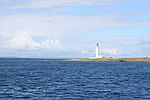
| Auskerry
|
|
Auskerry
|
Orkney
|
59° 1′ 33,7″ N, 2° 34′ 20,2″ W59.026014-2.572277
|
1866
|
|
|
|
| Bagi Stack
|

|
Yell
|
Shetland
|
60° 43′ 29″ N, 1° 7′ 35″ W60.72473-1.126379
|
|
|
|
|
| Barns Ness
|

|
nahe
Dunbar
|
East Lothian
|
55° 59′ 14,1″ N, 2° 26′ 42,8″ W55.987247-2.445221
|
1899
|
|
|
|
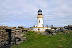
| Barra Head
|
|
Barra Head
|
Äußere Hebriden
|
56° 47′ 7,7″ N, 7° 39′ 12,5″ W56.785468-7.653477
|
1833
|
|
|
|
| Barrel of Butter
|

|
Barrel of Butter
|
Orkney
|
58° 53′ 25,5″ N, 3° 7′ 35,1″ W58.890415-3.126405
|
|
|
|
|
| Bass Rock
|

|
Bass Rock
|
East Lothian
|
56° 4′ 36,6″ N, 2° 38′ 28,6″ W56.076847-2.641273
|
1833
|
|
|
|
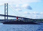
| Beamer Rock
|
|
nahe
North Queensferry
|
Fife
|
56° 0′ 16,8″ N, 3° 24′ 44,4″ W56.004661-3.412331
|
|
|
|
|
| Bell Rock
|

|
Inchcape
|
Angus
|
56° 26′ 3,1″ N, 2° 23′ 14,3″ W56.4342-2.3873
|
1810
|
|
|
|
| Bressay
|

|
Kirkabister
|
Shetland
|
60° 7′ 11,8″ N, 1° 7′ 16,9″ W60.119958-1.121373
|
1810
|
|
|
|
| Brough of Birsay
|

|
Brough of Birsay
|
Orkney
|
59° 8′ 12,8″ N, 3° 20′ 20,7″ W59.136875-3.339085
|
1925
|
|
|
|
| Buchan Ness
|

|
Boddam
|
Angus
|
57° 28′ 13,7″ N, 1° 46′ 27,8″ W57.470482-1.774376
|
1827
|
|
|
|
| Bullia Skerry
|
Die Wikipedia wünscht sich an dieser Stelle ein Bild vom hier behandelten Ort. Falls du dabei helfen möchtest, erklärt die Anleitung, wie das geht. |
Bullia Skerry
|
Shetland
|
60° 6′ 39,2″ N, 1° 21′ 34,2″ W60.110889-1.35951
|
|
|
|
|
| Butt of Lewis
|

|
Butt of Lewis
|
Äußere Hebriden
|
58° 30′ 56,2″ N, 6° 15′ 40,2″ W58.515618-6.261173
|
1862
|
|
|
|
| Cantick Head
|

|
nahe
Longhope
|
Orkney
|
58° 47′ 13,4″ N, 3° 7′ 52,8″ W58.787069-3.131343
|
1858
|
|
|
|
| Cape Wrath
|

|
Cape Wrath
|
Highland
|
58° 37′ 31,6″ N, 4° 59′ 55,8″ W58.625439-4.998823
|
1828
|
|
|
|
| Chanonry
|

|
Fortrose
|
Highland
|
57° 34′ 26,6″ N, 4° 5′ 33,7″ W57.574053-4.092687
|
1846
|
|
|
|
| Cloch Point
|

|
Gourock
|
Inverclyde
|
55° 56′ 32,5″ N, 4° 52′ 43,3″ W55.94236-4.878682
|
1797
|
|
|
|
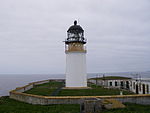
| Copinsay
|
|
Copinsay
|
Orkney
|
58° 53′ 46,9″ N, 2° 40′ 19,4″ W58.896366-2.672055
|
1915
|
|
|
|
| Corran Point
|

|
Corran Point
|
Highland
|
56° 43′ 15,1″ N, 5° 14′ 32,2″ W56.72085-5.242272
|
1817
|
|
|
|
| Corsewall
|

|
Kirkcolm
|
Dumfries and Galloway
|
55° 0′ 27″ N, 5° 9′ 29″ W55.0075-5.158056
|
1817
|
|
|
|
| Covesea Skerries
|

|
Lossiemouth
|
Moray
|
57° 43′ 27″ N, 3° 20′ 19″ W57.724153-3.338622
|
1846
|
|
|
|
| Crammag Head
|

|
Crammag Head
|
Dumfries and Galloway
|
54° 39′ 55″ N, 4° 57′ 53″ W54.66514-4.96482
|
1913
|
|
|
|
| Cromarty
|

|
Cromarty
|
Highland
|
57° 40′ 58,9″ N, 4° 2′ 11,3″ W57.683039-4.036486
|
1846
|
|
|
|
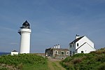
| Davaar
|
|
Davaar
|
Argyll and Bute
|
55° 25′ 41,6″ N, 5° 32′ 25,7″ W55.428219-5.540484
|
1854
|
|
|
|
| Dubh Artach
|

|
Dubh Artach
|
Argyll and Bute
|
56° 8′ 0″ N, 6° 38′ 0″ W56.133333-6.633333
|
1872
|
|
|
|
| Duncansby Head
|

|
Duncansby Head
|
Highland
|
58° 38′ 38,5″ N, 3° 1′ 30,4″ W58.644034-3.025114
|
1924
|
|
|
|
| Dunnet Head
|

|
Dunnet Head
|
Highland
|
58° 38′ 38,5″ N, 3° 1′ 30,4″ W58.644034-3.025114
|
1831
|
|
|
|
| Dunollie
|

|
Oban
|
Argyll and Bute
|
56° 25′ 22,5″ N, 5° 29′ 2,8″ W56.422917-5.484111
|
|
|
|
|
| Eilean Glas
|

|
Scalpay
|
Äußere Hebriden
|
57° 51′ 24,8″ N, 6° 38′ 31,4″ W57.856897-6.642062
|
1789
|
|
|
|
| Elie Ness
|

|
Elie and Earlsferry
|
Fife
|
56° 11′ 2,2″ N, 2° 48′ 46″ W56.183954-2.812787
|
1908
|
|
|
|
| Esha Ness
|

|
Northmavine
|
Shetland
|
60° 29′ 21,5″ N, 1° 37′ 38″ W60.489305-1.627216
|
1925
|
|
|
|
| Fair Isle North
|

|
Fair Isle
|
Shetland
|
59° 33′ 7,7″ N, 1° 36′ 34,3″ W59.552139-1.609519
|
1892
|
|
|
|
| Fair Isle South
|

|
Fair Isle
|
Shetland
|
59° 30′ 50″ N, 1° 39′ 8,8″ W59.513877-1.65244
|
1892
|
|
|
|
| Fidra
|

|
Fidra
|
East Lothian
|
56° 4′ 23,5″ N, 2° 47′ 6,5″ W56.073203-2.785143
|
1885
|
|
|
|
| Fife Ness
|

|
Fife Ness
|
Fife
|
56° 16′ 43,9″ N, 2° 35′ 9,1″ W56.278871-2.58587
|
1975
|
|
|
|
| Firths Voe
|
|
Mossbank
|
Shetland
|
60° 27′ 13″ N, 1° 10′ 37″ W60.45372-1.177
|
|
|
|
|
| Flannan Isles
|

|
Flannan Isles
|
Äußere Hebriden
|
58° 17′ 17,1″ N, 7° 35′ 16,5″ W58.28807-7.587907
|
1899
|
|
|
|
| Foula
|
Die Wikipedia wünscht sich an dieser Stelle ein Bild vom hier behandelten Ort. Falls du dabei helfen möchtest, erklärt die Anleitung, wie das geht. |
Foula
|
Shetland
|
60° 6′ 44,5″ N, 2° 3′ 50,3″ W60.11236-2.063982
|
1909
|
|
|
|
| Girdle Ness
|
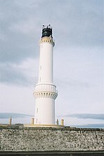
|
Aberdeen
|
Aberdeenshire
|
57° 8′ 20,6″ N, 2° 2′ 54,8″ W57.139051-2.048543
|
1833
|
|
|
|
| Holburn Head
|
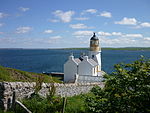
|
Scrabster
|
Highland
|
58° 36′ 52,7″ N, 3° 32′ 21,7″ W58.614643-3.539358
|
1862
|
|
|
[1]
|
| Hoxa Head
|

|
nahe Hoxa
|
Orkney
|
58° 49′ 18,7″ N, 3° 2′ 5″ W58.821864-3.034735
|
1901
1996
|
|
|
|
| Hoy Sound High
|

|
Graemsay
|
Orkney
|
58° 56′ 8,4″ N, 3° 16′ 23,5″ W58.935663-3.273194
|
|
|
|
|
| Hoy Sound Low
|

|
Graemsay
|
Orkney
|
58° 56′ 25,4″ N, 3° 18′ 36,1″ W58.940378-3.310029
|
|
|
|
|
| Hyskeir
|
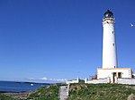
|
Hyskeir
|
Highland
|
56° 58′ 9,7″ N, 6° 40′ 49,6″ W56.969351-6.680456
|
|
|
|
|
| Inchkeith
|
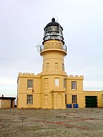
|
Inchkeith
|
Fife
|
56° 1′ 59,6″ N, 3° 8′ 11,9″ W56.033224-3.136646
|
|
|
|
|
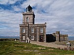
| Isle of May
|
|
Isle of May
|
Fife
|
56° 11′ 8,3″ N, 2° 33′ 26,9″ W56.18563-2.557471
|
|
|
|
|
| Killantringan
|

|
Portpatrick
|
Dumfries and Galloway
|
54° 51′ 42,6″ N, 5° 8′ 49,1″ W54.86183-5.146972
|
|
|
|
|
| Kinnaird Head
|

|
Fraserburgh
|
Aberdeenshire
|
57° 41′ 52,7″ N, 2° 0′ 16″ W57.697969-2.004439
|
|
|
|
|
| Lady Isle
|

|
Lady Isle
|
South Ayrshire
|
55° 31′ 38,3″ N, 4° 44′ 2,1″ W55.527307-4.733908
|
|
|
|
|
| Lismore
|

|
Eilean Musdile
|
Argyll and Bute
|
56° 27′ 20″ N, 5° 36′ 26,7″ W56.455564-5.607406
|
|
|
|
|
| Loch Eriboll
|

|
Loch Eriboll
|
Highland
|
58° 31′ 0,5″ N, 4° 38′ 54,3″ W58.516803-4.648424
|
|
|
|
|
| Low Light
|

|
Isle of May
|
Fife
|
56° 11′ 8,2″ N, 2° 32′ 59,4″ W56.185624-2.549834
|
|
|
|
|
| Monach Island
|

|
Shillay
|
Äußere Hebriden
|
57° 31′ 33,2″ N, 7° 41′ 42,2″ W57.525888-7.695045
|
|
|
|
|
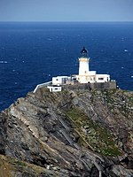
| Muckle Flugga
|
|
Muckle Flugga
|
Shetland
|
60° 51′ 19,5″ N, 0° 53′ 7,4″ W60.85542-0.885387
|
|
|
|
|
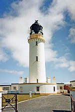
| Mull of Galloway
|
|
Mull of Galloway
|
Dumfries and Galloway
|
54° 38′ 6″ N, 4° 51′ 26,8″ W54.634996-4.857441
|
|
|
|
|
| Mull of Kintyre
|

|
Mull of Kintyre
|
Argyll and Bute
|
55° 18′ 37,5″ N, 5° 48′ 11,7″ W55.310416666667-5.80325
|
|
|
|
|
| Neist Point
|

|
Neist Point
|
Highland
|
57° 25′ 24,5″ N, 6° 47′ 17,7″ W57.423478-6.788248
|
|
|
|
|
| Newhaven
|

|
Edinburgh
|
Edinburgh
|
55° 58′ 56,3″ N, 3° 11′ 47,5″ W55.982301-3.196539
|
|
|
|
|
| North Ronaldsay
|

|
North Ronaldsay
|
Orkney
|
59° 23′ 22,9″ N, 2° 22′ 52,9″ W59.389689-2.381363
|
|
|
|
|
| Noss Head
|

|
Noss Head
|
Highland
|
58° 28′ 44,9″ N, 3° 3′ 2,8″ W58.479126-3.050772
|
|
|
|
|
| Noup Head
|

|
Noup Head
|
Orkney
|
59° 19′ 51,9″ N, 3° 4′ 13,2″ W59.331096-3.07032
|
|
|
|
|
| Ornsay
|

|
Ornsay
|
Highland
|
57° 8′ 36,3″ N, 5° 46′ 51,7″ W57.143426-5.781036
|
|
|
|
|
| Out Skerries
|

|
Bound Skerry
|
Shetland
|
60° 25′ 28″ N, 0° 43′ 41,1″ W60.424434-0.728071
|
|
|
|
|
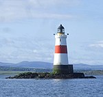
| Oxcars
|
|
Firth of Forth
|
Fife
|
56° 1′ 20,8″ N, 3° 16′ 48,8″ W56.022455-3.280226
|
|
|
|
|
| Pentland Skerries
|

|
Muckle Skerry
|
Orkney
|
58° 41′ 24,2″ N, 2° 55′ 28,2″ W58.690059-2.924505
|
|
|
|
|
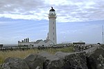
| Pladda
|
|
Pladda
|
North Ayrshire
|
55° 25′ 30″ N, 5° 7′ 5,7″ W55.424997-5.118259
|
|
|
|
|
| Port Ellen
|

|
The Oa
|
Argyll and Bute
|
55° 37′ 12,9″ N, 6° 12′ 42,1″ W55.62025-6.211694
|
|
|
|
|
| Rattray Head
|

|
nahe Crimond
|
Aberdeenshire
|
57° 36′ 36,6″ N, 1° 48′ 58,9″ W57.610156-1.816374
|
|
|
|
|
| Rhinns of Islay
|

|
Orsay
|
Argyll and Bute
|
55° 40′ 23″ N, 6° 30′ 47,2″ W55.673056-6.513111
|
|
|
|
|
| Rhuvaal
|

|
Ruvaal
|
Argyll and Bute
|
55° 56′ 10,9″ N, 6° 7′ 24,4″ W55.936361-6.123444
|
|
|
|
|
| Rona
|

|
Rona
|
Highland
|
57° 34′ 41,3″ N, 5° 57′ 32,6″ W57.578136-5.959054
|
|
|
|
|
| Rua Reidh
|

|
nahe Melvaig
|
Highland
|
57° 34′ 41,3″ N, 5° 57′ 32,6″ W57.578136-5.959054
|
|
|
|
|
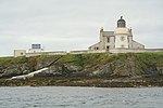
| Saeva Ness
|
|
Helliar Holm
|
Orkney
|
59° 1′ 8″ N, 2° 54′ 3,6″ W59.0189-2.901
|
|
|
|
|
| Sanda
|

|
Sanda
|
Argyll and Bute
|
55° 16′ 29,5″ N, 5° 34′ 57,8″ W55.274859-5.582719
|
|
|
|
|
| Scurdie Ness
|

|
Montrose
|
Angus
|
56° 42′ 6,4″ N, 2° 26′ 14,2″ W56.701767-2.437282
|
|
|
|
|
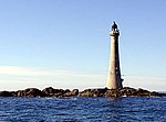
| Skerryvore
|
|
Skerryvore
|
Argyll and Bute
|
56° 19′ 4″ N, 7° 6′ 9″ W56.317778-7.1025
|
|
|
|
|
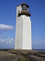
| Southerness
|
|
Toward
|
Dumfries and Galloway
|
54° 52′ 22,2″ N, 3° 35′ 42,1″ W54.872823-3.595025
|
|
|
|
|
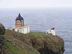
| St Abb’s Head
|
|
St Abb’s Head
|
Scottish Borders
|
55° 54′ 58,6″ N, 2° 8′ 19,7″ W55.916286-2.138802
|
|
|
|
|
| Start Point
|

|
Sanday
|
Orkney
|
59° 16′ 38,5″ N, 2° 22′ 33,3″ W59.277349-2.375907
|
|
|
|
|
| Stoer Head
|

|
nahe
Raffin
|
Highland
|
58° 14′ 24,1″ N, 5° 24′ 9,7″ W58.240028-5.402705
|
|
|
|
|
| Strathy Point
|

|
Strathy
|
Highland
|
58° 35′ 56,1″ N, 4° 1′ 6,9″ W58.598909-4.018575
|
|
|
|
|
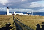
| Stroma
|
|
Stroma
|
Highland
|
58° 41′ 45,1″ N, 3° 7′ 0″ W58.695874-3.116675
|
|
|
|
|
| Sule Skerry
|
Die Wikipedia wünscht sich an dieser Stelle ein Bild vom hier behandelten Ort. Falls du dabei helfen möchtest, erklärt die Anleitung, wie das geht. |
Sule Skerry
|
Orkney
|
59° 5′ 4,9″ N, 4° 24′ 26,4″ W59.084697-4.407322
|
|
|
|
|
| Sumburgh Head
|

|
Sumburgh Head
|
Shetland
|
59° 51′ 14,6″ N, 1° 16′ 28,5″ W59.854047-1.274575
|
|
|
|
|
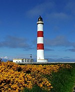
| Tarbat Ness
|
|
nahe
Portmahomack
|
Highland
|
57° 51′ 54,3″ N, 3° 46′ 35,5″ W57.86509-3.776514
|
|
|
|
|
| Tiumpan Head
|

|
Tiumpan Head
|
Äußere Hebriden
|
58° 15′ 39,3″ N, 6° 8′ 20,1″ W58.260917-6.138918
|
|
|
|
|
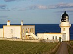
| Tod Head
|
|
nahe
Kinneff
|
Aberdeenshire
|
56° 53′ 1,7″ N, 2° 12′ 55″ W56.883794-2.215275
|
|
|
|
|
| Tor Ness
|

|
nahe
Melsetter
|
Orkney
|
58° 46′ 41,8″ N, 3° 17′ 47″ W58.778275-3.296379
|
|
|
|
|
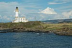
| Turnberry
|
|
Turnberry
|
South Ayrshire
|
55° 19′ 33,4″ N, 4° 50′ 39,9″ W55.325943-4.844416
|
|
|
|
|
| Ushenish
|
Die Wikipedia wünscht sich an dieser Stelle ein Bild vom hier behandelten Ort. Falls du dabei helfen möchtest, erklärt die Anleitung, wie das geht. |
South Uist
|
Äußere Hebriden
|
57° 17′ 54,3″ N, 7° 11′ 34,2″ W57.298406-7.192835
|
|
|
|
|
| Uyea Sound
|

|
Uyeasound
|
Shetland
|
60° 41′ 8,3″ N, 0° 55′ 27″ W60.685634-0.924169
|
|
|
|
|
| Valia Sound
|
Die Wikipedia wünscht sich an dieser Stelle ein Bild vom hier behandelten Ort. Falls du dabei helfen möchtest, erklärt die Anleitung, wie das geht. |
nahe
Whiteness
|
Shetland
|
60° 11′ 57,5″ N, 1° 33′ 27,7″ W60.199318-1.557705
|
|
|
|
|
| Ve Skerries
|
Die Wikipedia wünscht sich an dieser Stelle ein Bild vom hier behandelten Ort. Falls du dabei helfen möchtest, erklärt die Anleitung, wie das geht. |
Ve Skerries
|
Shetland
|
60° 22′ 23,2″ N, 1° 48′ 44,1″ W60.373113-1.812252
|
|
|
|
|
| Waternish Point
|

|
Waternish Point
|
Highland
|
57° 36′ 27,9″ N, 6° 38′ 2,9″ W57.607743-6.634139
|
|
|
|
|
| Weavers Point
|
|
Weavers Point
|
Äußere Hebriden
|
57° 36′ 29,5″ N, 7° 5′ 59,3″ W57.608189-7.099805
|
|
|
|
|
| Wether Holm
|
Die Wikipedia wünscht sich an dieser Stelle ein Bild vom hier behandelten Ort. Falls du dabei helfen möchtest, erklärt die Anleitung, wie das geht. |
Wether Holm
|
Shetland
|
60° 22′ 20,6″ N, 1° 1′ 19,8″ W60.37239-1.022153
|
|
|
|
|
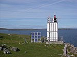
| Whitehill
|
|
Yell
|
Shetland
|
60° 34′ 47,8″ N, 1° 0′ 12,8″ W60.579939-1.00356
|
|
|
|
|


