Datei:Map of the grassland ecoregions of the United States.jpg
Größe dieser Vorschau: 800 × 498 Pixel. Weitere Auflösungen: 320 × 199 Pixel | 640 × 398 Pixel | 1.024 × 637 Pixel | 1.280 × 797 Pixel | 2.826 × 1.759 Pixel
Originaldatei (2.826 × 1.759 Pixel, Dateigröße: 1,97 MB, MIME-Typ: image/jpeg)
![]()
Diese Datei und die Informationen unter dem roten Trennstrich werden aus dem zentralen Medienarchiv Wikimedia Commons eingebunden.
![]()
Beschreibung
| Beschreibung |
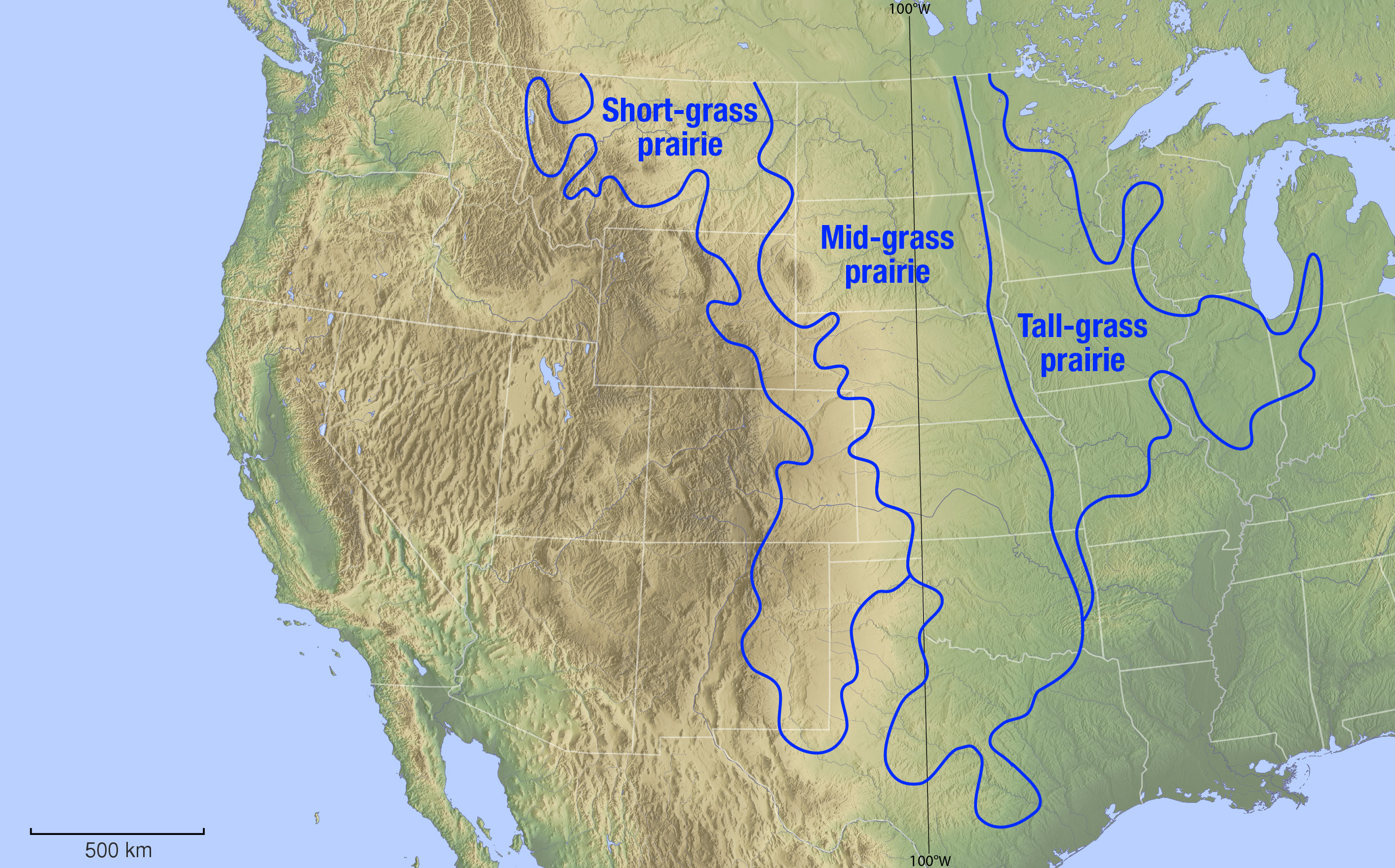
English: Biogeographical map showing the different temperate grassland ecoregions of the Great Plains and Tallgrass prairies regions of the United States. Data from a display at Brigham Young University's Bean museum. |
| Datum | see file history |
| Quelle |
Eigenes Werk, using |
| Urheber | Maximilian Dörrbecker (Chumwa) |
| Genehmigung (Weiternutzung dieser Datei) |
Ich, der Urheber dieses Werkes, veröffentliche es unter der folgenden Lizenz: Diese Datei ist unter der Creative-Commons-Lizenz „Namensnennung – Weitergabe unter gleichen Bedingungen 2.5 generisch“ (US-amerikanisch) lizenziert.
Sie dürfen das Bild zu den folgenden Bedingungen nutzen:
|
Dateiversionen
Klicke auf einen Zeitpunkt, um diese Version zu laden.
| Version vom | Vorschaubild | Maße | Benutzer | Kommentar | |
|---|---|---|---|---|---|
| aktuell | 20:43, 25. Nov. 2013 | | 2.826 × 1.759 (1,97 MB) | Chumwa | |
| 20:17, 22. Nov. 2013 |  | 2.826 × 1.761 (2,12 MB) | Chumwa | == {{int:filedesc}} == {{Information | Description = {{en|1=Biogeographical map showing the different temperate grassland ecoregions of the Great Plains and Tallgrass prairies regions of the United States. Data from a display at Brigham Young Universi... |
Dateiverwendung
Die folgenden 2 Seiten verwenden diese Datei:
Globale Dateiverwendung
Die nachfolgenden anderen Wikis verwenden diese Datei:
- Verwendung auf la.wikipedia.org