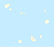
Farol do Morro Negro
| Farol do Morro Negro | ||
|---|---|---|
 | ||
| Ort: | Morro Negro Boa Vista Kap Verde | |
| Lage: | Boa Vista, Ilhas de Barlavento, Kap Verde | |
| Geographische Lage: | 16° 6′ 8,8″ N, 22° 40′ 39″ W | |
| Feuerhöhe: | 163 m | |
|
| ||
| Nenntragweite weiß: | 31 sm (57,4 km) | |
| Funktion: | Leuchtturm | |
| Bauzeit: | 1930 | |
Der Farol do Morro Negro (dt.: „Leuchtturm des Morro Negro“) ist ein Leuchtturm am östlichsten Punkt der Insel Boa Vista im atlantischen Inselstaat Kap Verde.[1] Der Leuchtturm steht ca. 4 km östlich des nächsten Dorfes, Cabeça dos Tarrafes. Der Leuchtturm wird von der Direcção Geral de Marinha e Portos (DGMP) betrieben.[2]
Architektur
BearbeitenDie Konstruktion ist 12 m hoch und die Feuerhöhe liegt bei 163 CV-BVVorlage:Höhe/unbekannter Bezug. Der Turm ist ein quadratischer Turm mit Balkon und Laterne angebaut an ein einstöckiges Leuchtturmwärterhaus. Das Signal besteht aus einem weißen Blitz in einer Periode von zwanzig Sekunden. Die Reichweite beträgt 31 nms (ca. 57,4 km).[3]
Identifikationen: Amateur Radio Lighthouse Society (ARLHS): CAP-005 PT-2102 - United Kingdom Hydrographic Office (Admiralty): D2914 - National Geospatial-Intelligence Agency (NGA): 113-24196.[4]
Siehe auch
BearbeitenEinzelnachweise
Bearbeiten- ↑ Cabo Verde, Statistical Yearbook 2015. Instituto Nacional de Estatística. ine.cv S. 26.
- ↑ DGMP. ( vom 26. Oktober 2017 im Internet Archive) sia.cv.
- ↑ List of Lights, Pub. 113: The West Coasts of Europe and Africa, the Mediterranean Sea, Black Sea and Azovskoye More (Sea of Azov) (PDF; 3,2 MB). List of Lights. United States National Geospatial-Intelligence Agency. msi.nga.mil 2018: S. 427.
- ↑ Russ Rowlett: Lighthouses of Cape Verde. The Lighthouse Directory. University of North Carolina at Chapel Hill. ibiblio.org.
