Liste der Landschaftsschutzgebiete im Landkreis Osnabrück
Wikimedia-Liste
Die Liste der Landschaftsschutzgebiete im Landkreis Osnabrück enthält die Landschaftsschutzgebiete des Landkreises Osnabrück in Niedersachsen.
| Bild | Nummer | Bezeichnung des Gebietes | Fläche in Hektar | WDPA-ID | Koordinaten[1] | Datum der Verordnung |
|---|---|---|---|---|---|---|
| LSG OS 00001 | Naturpark Nördlicher Teutoburger Wald - Wiehengebirge | 34694,50 | 323135 | Position | 1965 | |
 |
LSG OS 00002 | Wald im Westerhauser Bruch | 3,00 | 325516 | Position | 1954 |
 |
LSG OS 00003 | Wulbergsheide | 40,00 | 325945 | Position | 1954 |
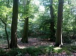 |
LSG OS 00004 | Kohlflage | 3,00 | 322254 | Position | 1954 |
 |
LSG OS 00005 | Wald bei Schloß Gesmold | 11,00 | 325513 | Position | 1954 |
 |
LSG OS 00006 | Das Loh bei Gesmold | 6,40 | 320281 | Position | 1954 |
 |
LSG OS 00007 | Grönenberg | 9,00 | 321171 | Position | 1954 |
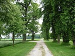 |
LSG OS 00008 | Brucher Holz | 13,00 | 320112 | Position | 1954 |
 |
LSG OS 00009 | Strothheide | 21,00 | 324891 | Position | 1954 |
 |
LSG OS 00010 | Wäldchen bei Buer | 3,90 | 325542 | Position | 1954 |
 |
LSG OS 00011 | Waldgebiet bei Tittingdorf | 15,00 | 325565 | Position | 1954 |
 |
LSG OS 00012 | Düingdorfer Berg | 58,00 | 320459 | Position | 1954 |
 |
LSG OS 00013 | Limberg und Dieselkamp | 13,00 | 322608 | Position | 1954 |
 |
LSG OS 00016 | Riemsloher Wald | 220,00 | 323888 | Position | 1954 |
 |
LSG OS 00017 | Waldgebiet in Döhren | 49,40 | 325569 | Position | 1954 |
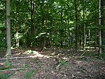 |
LSG OS 00018 | Waldgebiet bei Neuenkirchen | 19,00 | 325564 | Position | 1954 |
 |
LSG OS 00019 | Warmenau-Ufer | 1,00 | 325652 | Position | 1954 |
 |
LSG OS 00020 | Königsbrück | 15,00 | 322269 | Position | 1954 |
 |
LSG OS 00021 | Brennenheide | 21,00 | 320083 | Position | 1954 |
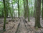 |
LSG OS 00022 | Horstmanns Holz | 49,00 | 321771 | Position | 1954 |
 |
LSG OS 00023 | Pferdebruch | 25,00 | 323668 | Position | 1954 |
 |
LSG OS 00024 | Waldgebiet in Eickholt | 15,00 | 325553 | Position | 1954 |
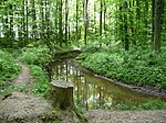 |
LSG OS 00025 | Waldgebiete bei Dielingdorf und Handarpe | 32,00 | 325601 | Position | 1954 |
 |
LSG OS 00026 | Waldgebiete bei Gerden | 19,00 | 325602 | Position | 1954 |
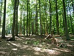 |
LSG OS 00027 | Waldgebiete um Sondermühlen | 241,40 | 325604 | Position | 1954 |
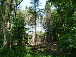 |
LSG OS 00028 | Wiedebrocksheide | 250,00 | 325858 | Position | 1954 |
 |
LSG OS 00029 | Waldgebiete bei Schlochtern | 24,00 | 325603 | Position | 1954 |
| LSG OS 00031 | Im Hamme | 9,00 | 321893 | Position | 1955 | |
| LSG OS 00032 | Streithorst | 4,00 | 324881 | Position | 1959 | |
| LSG OS 00033 | Schelenbusch | 7,30 | 324135 | Position | 1959 | |
| LSG OS 00034 | Staatsforst Diepholz | 111,30 | 324748 | Position | 1969 | |
| LSG OS 00035 | Königstannen | 45,40 | 322275 | Position | 1959 | |
| LSG OS 00036 | An der Tappenburg | 38,50 | 319638 | Position | 1959 | |
| LSG OS 00037 | Waldgebiet Hinterbruch | 236,00 | 325568 | Position | 1959 | |
| LSG OS 00038 | Langelage | 98,20 | 322499 | Position | 1959 | |
| LSG OS 00039 | Meyer zu Broxten | 17,40 | 322964 | Position | 1959 | |
| LSG OS 00040 | Bohmter Heide | 406,00 | 320016 | Position | 1959 | |
 |
LSG OS 00041 | Ippenburg | 48,90 | 321963 | Position | 1959 |
| LSG OS 00042 | Hünnefeld | 100,00 | 321850 | Position | 1959 | |
| LSG OS 00043 | Rottwald (Wald östlich der Hunte) | 54,00 | 323998 | Position | 1959 | |
| LSG OS 00044 | Hunte zwischen Barkhausen und Wittlage | 14,90 | 321851 | Position | 1959 | |
| LSG OS 00045 | Arenshorst | 83,40 | 319658 | Position | 1959 | |
 |
LSG OS 00046 | Park bei Gut Vehr | 5,20 | 323622 | Position | 1950 |
| LSG OS 00047 | Dümmer | 9,2 | 320462 | Position | 1981 | |
 |
LSG OS 00048 | Kilverbachtal | 122,00 | 322121 | Position | 1959 |

|
LSG OS 00049 | Teutoburger Wald | 11369,90 | 329212 | Position | 2004 |
 |
LSG OS 00050 | Wiehengebirge und Nördliches Osnabrücker Hügelland | 28839,10 | 390425 | Position | 2009 |
Anmerkungen
Bearbeiten- ↑ Koordinaten wurden dem European Nature Information System (EUNIS) der Europäischen Umweltagentur entnommen: Nationally designated areas (CDDA), Datei CDDA_v12_csv.zip, Stand Oktober 2014. Die Tabellenspalte WDPA-ID gibt die genauen Grenzen an.
Siehe auch
BearbeitenWeblinks
BearbeitenCommons: Landschaftsschutzgebiete im Landkreis Osnabrück – Sammlung von Bildern