Liste der Naturschutzgebiete im Landkreis Dahme-Spreewald
Wikimedia-Liste
Im Brandenburger Landkreis Dahme-Spreewald gibt es 77 Naturschutzgebiete (Stand Februar 2017).
| Name des Gebietes | Bild | Kennung | WDPA | Landkreis / Stadt | Beschreibung / Bemerkungen | Standort | Fläche in Hektar | Datum der Verordnung |
|---|---|---|---|---|---|---|---|---|
| Alteno-Radden | 1302 | 318096 | Landkreis Dahme-Spreewald, Landkreis Oberspreewald-Lausitz | Position | 33,43 | 29.03.2003 | ||
| Bergen-Weißacker Moor |  |
1319 | 318185 | Landkreis Dahme-Spreewald | Position | 115,47 | 26.03.1981, 01.07.2007 | |
| Biebersdorfer Wiesen | 1272 | 318194 | Landkreis Dahme-Spreewald | Position | 16,5 | 01.10.1990 | ||
| Birkenwald | 1293 | 162432 | Landkreis Dahme-Spreewald | Position | 64,97 | 01.10.1990 | ||
| Borcheltsbusch und Brandkieten | 1307 | 14429 | Landkreis Dahme-Spreewald | Position | 141,74 | 26.03.1981 | ||
| Börnichen | 1271 | 162506 | Landkreis Dahme-Spreewald | Position | 21,59 | 01.10.1990 | ||
| Brasinski-Luch | 1234 | 162537 | Landkreis Dahme-Spreewald | Position | 12,41 | 01.10.1990 | ||
| Briesener Luch | 1277 | 162562 | Landkreis Dahme-Spreewald | Position | 46,55 | 24.06.1992 | ||
| Briesensee und Klingeberg |  |
1245 | 318240 | Landkreis Dahme-Spreewald | Position | 79,19 | 01.07.2002 | |
| Bukoitza |  |
1291 | 162635 | Landkreis Dahme-Spreewald | Position | 14,54 | 01.10.1990 | |
| Byhleguhrer See |  |
1289 | 162669 | Landkreis Dahme-Spreewald | Position | 853,45 | 01.10.1990 | |
| Dahmetal bei Briesen | 1257 | 389581 | Landkreis Dahme-Spreewald | Position | 423,45 | 31.07.2008 | ||
| Dammer Moor | 1263 | 162699 | Landkreis Dahme-Spreewald | Position | 171,04 | 16.05.1990 | ||
| Dammühlenfließniederung | 1452 | 318279 | Landkreis Dahme-Spreewald, Landkreis Oder-Spree | Position | 79,13 | 29.10.1998 | ||
| Dolgensee | 
|
1207 | 162769 | Landkreis Dahme-Spreewald | Position | 308,45 | 28.06.1995, 26.08.2011 | |
| Dollgener Grund |  |
1270 | 162774 | Landkreis Dahme-Spreewald | Position | 71,61 | 24.06.1992 | |
| Dubrow |  |
1218 | 14400 | Landkreis Dahme-Spreewald | Position | 212,52 | 01.05.1961 | |
| Dürrenhofer Moor | 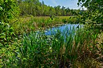 |
1625 | 555552558 | Landkreis Dahme-Spreewald | Position | 14,03 | 23.06.2012 | |
| Ellerborn | 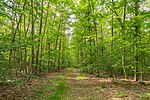 |
1295 | 162923 | Landkreis Dahme-Spreewald | Position | 57,49 | 01.10.1990 | |
| Flutgrabenaue Waltersdorf | 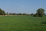 |
1180 | 318405 | Landkreis Dahme-Spreewald | Position | 287,98 | 03.04.1998 | |
| Görlsdorfer Wald |  |
1438 | 318450 | Landkreis Dahme-Spreewald | Position | 195,2 | 01.07.2002 | |
| Hain Lübben | 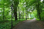 |
1284 | 163483 | Landkreis Dahme-Spreewald | Position | 18,26 | 01.10.1990 | |
| Heideseen | 
|
1252 | 163592 | Landkreis Dahme-Spreewald | Position | 238,64 | 01.10.1990 | |
| Höllengrund – Pulverberg |  |
1188 | 163767 | Landkreis Dahme-Spreewald | Position | 15,15 | 28.06.1995 | |
| Innerer Oberspreewald | 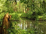 |
1288 | 102244 | Landkreis Dahme-Spreewald, Landkreis Oberspreewald-Lausitz, Landkreis Spree-Neiße | Position | 5744,8 | 01.10.1990 | |
| Innerer Unterspreewald | 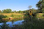 |
1254 | 64688 | Landkreis Dahme-Spreewald | Position | 2231,33 | 01.10.1990 | |
| Josinsky-Luch | 1235 | 163955 | Landkreis Dahme-Spreewald | Position | 172,1 | 01.10.1990 | ||
| Katzenberge | 1547 | 329481 | Landkreis Dahme-Spreewald | Position | 141,23 | 25.06.2004 | ||
| Kleine und Mittelleber |  |
1240 | 164115 | Landkreis Dahme-Spreewald | Position | 77,49 | 28.06.1995 | |
| Kockot |  |
1255 | 164176 | Landkreis Dahme-Spreewald | Position | 286,77 | 01.10.1990 | |
| Krossener Busch | 1292 | 318692 | Landkreis Dahme-Spreewald | Position | 60,71 | 05.06.2002 | ||
| Lehnigksberg |  |
1280 | 164415 | Landkreis Dahme-Spreewald | Position | 13,06 | 01.10.1990 | |
| Leue | 1225 | 164441 | Landkreis Dahme-Spreewald | Position | 3,79 | 15.01.1938 | ||
| Lieberoser Endmoräne |  |
1275 | 318731 | Landkreis Dahme-Spreewald, Landkreis Spree-Neiße | Position | 6714,15 | 18.01.2000 | |
| Linowsee-Dutzendsee |  |
1222 | 164469 | Landkreis Dahme-Spreewald, Landkreis Oder-Spree | Position | 60 | 10.10.1995 | |
| Löptener Fenne-Wustrickwiesen |  |
1144 | 318749 | Landkreis Dahme-Spreewald | Position | 218,01 | 29.05.1998 | |
| Luchsee |  |
1259 | 164516 | Landkreis Dahme-Spreewald | Position | 113,14 | 01.10.1990 | |
| Mahnigsee-Dahmetal | 
|
1246 | 318761 | Landkreis Dahme-Spreewald | Position | 329,62 | 20.02.1998 | |
| Meiereisee | 1269 | 164598 | Landkreis Dahme-Spreewald | Position | 25,06 | 01.10.1990 | ||
| Mühlenfließ-Sägebach | 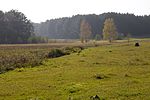
|
1239 | 318819 | Landkreis Dahme-Spreewald | Position | 163,23 | 13.02.1998 | |
| Naturentwicklungsgebiet Abramka | 1288 | 555558900 | Landkreis Dahme-Spreewald | Position | 101,74 | 22.09.2014 | ||
| Naturentwicklungsgebiet Kockot | 1255 | 555558899 | Landkreis Dahme-Spreewald | Position | 26,24 | 22.09.2014 | ||
| Neu Zaucher Weinberg |  |
1290 | 164783 | Landkreis Dahme-Spreewald | Position | 37,6 | 01.10.1990 | |
| Neuendorfer Seewiesen | 1241 | 164790 | Landkreis Dahme-Spreewald | Position | 67,82 | 01.10.1990 | ||
| Ostufer Stoßdorfer See | 1569 | 318928 | Landkreis Dahme-Spreewald | Position | 122,99 | 18.12.2003 | ||
| Pätzer Hintersee | 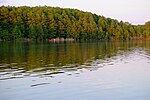 |
1213 | 318935 | Landkreis Dahme-Spreewald | Position | 461,78 | 20.02.1998 | |
| Pätzer Kiesgrube |  |
1220 | 318936 | Landkreis Dahme-Spreewald | Position | 15,48 | 07.05.2002 | |
| Prierow bei Golßen | 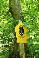 |
1273 | 165038 | Landkreis Dahme-Spreewald | Position | 60,63 | 26.03.1981 | |
| Prierowsee |  |
1210 | 14403 | Landkreis Dahme-Spreewald, Landkreis Teltow-Fläming | Position | 210,75 | 26.06.1978 | |
| Radeberge | 1223 | 329584 | Landkreis Dahme-Spreewald | Position | 286,09 | 16.06.2004 | ||
| Reicherskreuzer Heide und Schwansee | 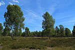 |
1418 | 165130 | Landkreis Dahme-Spreewald, Landkreis Oder-Spree, Landkreis Spree-Neiße | Position | 2809,03 | 09.12.1995 | |
| Replinchener See | 1539 | 318976 | Landkreis Dahme-Spreewald | Position | 12,28 | 07.05.2002 | ||
| Ribocka | 
|
1294 | 165171 | Landkreis Dahme-Spreewald | Position | 49,59 | 01.10.1990 | |
| Rochauer Heide | 
|
1310 | 14436 | Landkreis Dahme-Spreewald, Landkreis Teltow-Fläming | Position | 557,29 | 26.03.1981 | |
| Quellgebiet der Schuge und des Mühlenfließes | 1439 | 319089 | Landkreis Dahme-Spreewald | Position | 350,16 | 01.07.2002 | ||
| Schwarzes Luch | 1268 | 165510 | Landkreis Dahme-Spreewald | Position | 18,04 | 05.07.1992 | ||
| Skabyer Torfgraben | 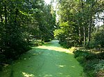 |
1192 | 319115 | Landkreis Dahme-Spreewald | Position | 304,89 | 26.09.1998 | |
| Sölla | 1244 | 165592 | Landkreis Dahme-Spreewald | Position | 33,39 | 01.10.1990 | ||
| Stintgraben |  |
1130 | 165742 | Landkreis Dahme-Spreewald | Position | 109,31 | 28.06.1995 | |
| Stockshof – Behlower Wiesen | 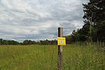 |
1433 | 319163 | Landkreis Dahme-Spreewald | Position | 487,48 | 18.12.2003 | |
| Storkower Kanal | 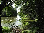 |
1202 | 329658 | Landkreis Dahme-Spreewald, Landkreis Oder-Spree | Position | 96,19 | 16.06.2004 | |
| Stegranzsee-Dahme | 1214 | 319168 | Landkreis Dahme-Spreewald | Position | 435,64 | 09.10.1999 | ||
| Sutschketal |  |
1208 | 165806 | Landkreis Dahme-Spreewald | Position | 59,66 | 10.10.1995 | |
| Teufelsluch |  |
1256 | 165866 | Landkreis Dahme-Spreewald | Position | 38,48 | 24.06.1992 | |
| Tiergarten |  |
1197 | 165895 | Landkreis Dahme-Spreewald | Position | 155,47 | 10.10.1995 | |
| Töpchiner Seen | 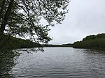
|
1224 | 319219 | Landkreis Dahme-Spreewald | Position | 373,34 | 29.05.1998 | |
| Torfbusch |  |
1565 | 165926 | Landkreis Dahme-Spreewald | Position | 47,48 | 06.01.1937 | |
| Uferwiesen bei Niewisch | 1453 | 319233 | Landkreis Dahme-Spreewald, Landkreis Oder-Spree | Position | 5,36 | 19.11.1999 | ||
| Urstromtal bei Golßen | 1609 | 389988 | Landkreis Dahme-Spreewald | Position | 433,66 | 28.10.2009 | ||
| Verlandungszone Köthener See | 1251 | 166052 | Landkreis Dahme-Spreewald | Position | 66,46 | 01.10.1990 | ||
| Wacholderschluchten Hohendorf |  |
1285 | 166117 | Landkreis Dahme-Spreewald | Position | 34,4 | 26.03.1981 | |
| Wanninchen |  |
1313 | 319290 | Landkreis Dahme-Spreewald | Position | 692,47 | 23.12.1999 | |
| Wernsdorfer See |  |
1176 | 14411 | Landkreis Dahme-Spreewald, Landkreis Oder-Spree | Position | 139,22 | 19.10.1967 | |
| Wiesenau | 
|
1276 | 166301 | Landkreis Dahme-Spreewald | Position | 134,85 | 01.10.1990 | |
| Wudritzniederung Willmersdorf-Stöbritz | 1550 | 319355 | Landkreis Dahme-Spreewald | Position | 43,07 | 07.05.2002 | ||
| Wutscherogge | 1238 | 166385 | Landkreis Dahme-Spreewald | Position | 7,7 | 01.10.1990 | ||
| Zützener Busch | 1281 | 319372 | Landkreis Dahme-Spreewald | Position | 91,03 | 18.06.2003 |
Quellen
BearbeitenWeblinks
BearbeitenCommons: Naturschutzgebiete im Landkreis Dahme-Spreewald – Sammlung von Bildern, Videos und Audiodateien